
- elevation 943 ft (287 m) - average 369 cu ft/s (10 m/s) Bridges Long Shoals Bridge | - elevation 722 ft (220 m) Length 142 km | |
 | ||
- location Vernon County, Missouri | ||
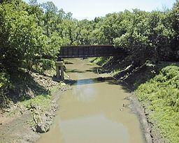
The Little Osage River is an 88-mile-long (142 km) tributary of the Osage River in eastern Kansas and western Missouri in the United States. Via the Osage and Missouri rivers, it is part of the watershed of the Mississippi River.
Contents
Map of Little Osage River, Kansas, USA
The name was derived from the Osage Nation.
CourseEdit
The Little Osage rises in Kansas in southeastern Anderson and northeastern Allen counties as three short streams, the North, Middle and South Forks. The forks converge in northwestern Bourbon County, and the river flows generally eastward past Fulton into Vernon County, Missouri, where it passes Stotesbury and collects the Marmaton River. On the boundary of Vernon and Bates counties, the Little Osage joins the Marais des Cygnes River to form the Osage River, 6 miles (10 km) west of Schell City.