
Country United States FIPS code 29-18802 Elevation 238 m Zip code 64741 Local time Sunday 8:19 AM | Time zone Central (CST) (UTC-6) GNIS feature ID 0716817 Area 26 ha Population 81 (2013) Area code 417 | |
 | ||
Weather 13°C, Wind S at 29 km/h, 76% Humidity | ||
Deerfield is a village in Vernon County, Missouri, United States. The population was 81 at the 2010 census.
Contents
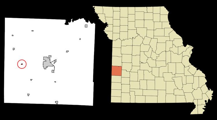
Map of Deerfield, MO 64741, USA
History
Deerfield was first settled in the 1830s. The town site was platted in 1871, taking its name from Deerfield Township. A post office called Deerfield has been in operation since 1856.
Geography
Deerfield is located at 37°50′20″N 94°30′25″W (37.839003, -94.506819), along the Marmaton River.
According to the United States Census Bureau, the village has a total area of 0.10 square miles (0.26 km2), all land.
2010 census
As of the census of 2010, there were 81 people, 33 households, and 24 families residing in the village. The population density was 810.0 inhabitants per square mile (312.7/km2). There were 34 housing units at an average density of 340.0 per square mile (131.3/km2). The racial makeup of the village was 95.1% White, 1.2% Native American, 1.2% Asian, and 2.5% from two or more races.
There were 33 households of which 36.4% had children under the age of 18 living with them, 66.7% were married couples living together, 6.1% had a male householder with no wife present, and 27.3% were non-families. 21.2% of all households were made up of individuals and 9.1% had someone living alone who was 65 years of age or older. The average household size was 2.45 and the average family size was 2.88.
The median age in the village was 39.6 years. 23.5% of residents were under the age of 18; 9.8% were between the ages of 18 and 24; 23.3% were from 25 to 44; 28.4% were from 45 to 64; and 14.8% were 65 years of age or older. The gender makeup of the village was 53.1% male and 46.9% female.
2000 census
As of the census of 2000, there were 75 people, 33 households, and 19 families residing in the village. The population density was 727.6 people per square mile (289.6/km²). There were 38 housing units at an average density of 368.7 per square mile (146.7/km²). All residents were White. 1.33% of the population were Hispanic or Latino.
There were 33 households out of which 27.3% had children under the age of 18 living with them, 48.5% were married couples living together, 9.1% had a female householder with no husband present, and 42.4% were non-families. 39.4% of all households were made up of individuals and 30.3% had someone living alone who was 65 years of age or older. The average household size was 2.27 and the average family size was 3.11.
In the village, the population was spread out with 24.0% under the age of 18, 10.7% from 18 to 24, 26.7% from 25 to 44, 20.0% from 45 to 64, and 18.7% who were 65 years of age or older. The median age was 36 years. For every 100 females there were 97.4 males. For every 100 females age 18 and over, there were 90.0 males.
The median income for a household in the village was $26,667, and the median income for a family was $31,667. Males had a median income of $18,542 versus $23,750 for females. The per capita income for the village was $11,065. There were no families and 9.3% of the population living below the poverty line, including 15.0% of under eighteens and 35.7% of those over 64.