
Effective April 1, 1981 Time zone EST (UTC−5) Area 39,246 km² Province Québec | Area code(s) 418 and 581 Population 32,012 (2011) University Cégep de Baie-Comeau | |
 | ||
Points of interest Mont Ti‑Basse, Parc Nature de Pointe‑Aux‑Outardes, Les Monts Groulx, Mount Babel | ||
Manicouagan is a regional county municipality in the Côte-Nord region of Quebec, Canada. It is located on the north shore of the Saint Lawrence River with its seat in Baie-Comeau. It was created in 1981, and named after the Manicouagan River.
Contents
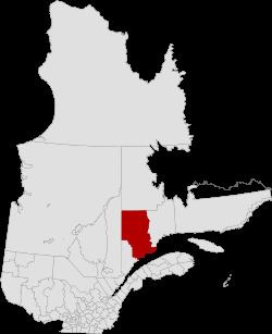
Map of Manicouagan Regional County Municipality, QC, Canada
Subdivisions
There are 9 subdivisions and one native reserve within the RCM:
(not associated with RCM)
Access Routes
Highways and numbered routes that run through the municipality, including external routes that start or finish at the county border:
References
Manicouagan Regional County Municipality Wikipedia(Text) CC BY-SA