
Length 107.8 km | ||
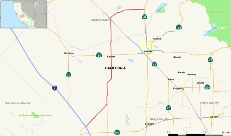 | ||
State Route 145 is a state highway in California, USA, which runs through the heart of the San Joaquin Valley from Interstate 5 north to Route 41 north of Fresno.
Contents
Map of CA-145, California, USA
Route description
SR 145 is part of the California Freeway and Expressway System.
SR 145 travels through the center of the San Joaquin Valley, remaining a rural two-lane road in its entirety. The southern terminus of SR 145 is at I-5 near Coalinga. SR 145 heads northeast as Fresno-Coalinga Road, turning north at the junction with SR 269 in Five Points, where it assumes the designation as Lassen Avenue. After passing through the town of Helm, SR 145 heads northeast as McMullin Grade, before turning north again as South Madera Avenue. SR 145 intersects with SR 180 in the city of Kerman, where it continues north to cross into Madera County. After passing through Ripperdan, SR 145 intersects SR 99 in Madera. From Madera, the route turns east, and ends at SR 41.
Various crops such as cotton, table grapes, tomatoes and melons are grown along the route in one of the most productive agricultural areas in the world.
Major intersections
Except where prefixed with a letter, postmiles were measured on the road as it was in 1964, based on the alignment that existed at the time, and do not necessarily reflect current mileage. R reflects a realignment in the route since then, M indicates a second realignment, L refers an overlap due to a correction or change, and T indicates postmiles classified as temporary (for a full list of prefixes, see the list of postmile definitions). Segments that remain unconstructed or have been relinquished to local control may be omitted. The numbers reset at county lines; the start and end postmiles in each county are given in the county column.