
Length 137 km | ||
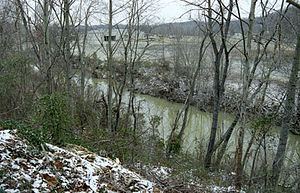 | ||
The Little Sandy River is a tributary of the Ohio River in northeastern Kentucky in the United States. It is 85.4 miles (137.4 km) long drains an area of 724.2 square miles (1,876 km2). Via the Ohio, it is part of the Mississippi River watershed.
Contents
Map of Little Sandy River, Kentucky, USA
CourseEdit
The Little Sandy rises in southern Elliott County and flows generally north-northeastwardly in a meandering course through Elliott, Carter and Greenup counties, through the towns of Sandy Hook and Grayson. It joins the Ohio River at Greenup.
DamsEdit
A U.S. Army Corps of Engineers dam in Carter County causes the river to widen as Grayson Lake in southern Carter and northern Elliott Counties. Grayson Lake State Park is located along this impoundment.
East Fork Little Sandy RiverEdit
The East Fork Little Sandy River, 48.3 miles (77.7 km) long, joins the main stream in Greenup County. It rises in northern Lawrence County and initially flows eastwardly before turning north-northwestwardly through Boyd and Greenup Counties. It flows past the Ashland suburb of Cannonsburg.