
Area 2,683 km² Population 362,437 (2013) | Founded 26 February 1773 | |
 | ||
Website www.co.westmoreland.pa.us Colleges and Universities Westland County Communi, Seton Hill University, Saint Vincent College, University of Pittsburg, Penn State New Kensington Points of interest Idlewild and Soak Zone, Bushy Run Battlefield, Westland Museum of American, Fort Ligonier, Keystone State Park | ||
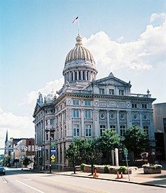
Westmoreland County is a county located in the U.S. state of Pennsylvania. At the 2010 census, the population was 365,169. The county seat is Greensburg. Cut from Lancaster, Northumberland, and later Bedford Counties, Westmoreland County was founded on February 26, 1773 and was the first county in the colony of Pennsylvania in which its entire territorial boundary was located west of the Allegheny Mountains. Westmoreland County originally included the present-day counties of Fayette, Washington, Greene, and parts of Beaver, Allegheny, Indiana, and Armstrong counties. It is named for Westmorland, a historic county of England.
Contents
- Map of Westmoreland County PA USA
- Geography
- Adjacent counties
- Major Highways
- Demographics
- Politics and government
- County commissioners
- Other county officials
- Public school districts
- Public charter schools
- Private high school
- Colleges and universities
- Recreation
- Communities
- Cities
- Census designated places
- Former community
- Population ranking
- Notable people
- References
Map of Westmoreland County, PA, USA
Westmoreland County is included in the Pittsburgh, PA Metropolitan Statistical Area.
A major coal strike occurred in the county in the winter of 1910–11.
Geography
According to the U.S. Census Bureau, the county has a total area of 1,036 square miles (2,680 km2), of which 1,028 square miles (2,660 km2) is land and 8.5 square miles (22 km2) (0.8%) is water.
Adjacent counties
Major Highways
Demographics
At the 2000 census, there were 369,993 people, 149,813 households and 104,569 families residing in the county. The population density was 361 per square mile (139/km²). There were 161,058 housing units at an average density of 157 per square mile (61/km²). The racial makeup of the county was 96.58% White, 2.01% Black or African American, 0.09% Native American, 0.52% Asian, 0.02% Pacific Islander, 0.15% from other races, and 0.64% from two or more races. 0.51% of the population were Hispanic or Latino of any race. 23.7% were of German, 18.5% Italian, 9.7% Irish, 8.9% Polish, 6.7% English, 5.2% Slovak and 5.0% American ancestry according to Census 2000.
There were 149,813 households of which 28.40% had children under the age of 18 living with them, 57.00% were married couples living together, 9.60% had a female householder with no husband present, and 30.20% were non-families. 26.90% of all households were made up of individuals and 13.30% had someone living alone who was 65 years of age or older. The average household size was 2.41 and the average family size was 2.93.
22.00% of the population were under the age of 18, 6.80% from 18 to 24, 27.50% from 25 to 44, 25.40% from 45 to 64, and 18.30% who were 65 years of age or older. The median age was 41 years. For every 100 females there were 93.10 males. For every 100 females age 18 and over, there were 89.70 males.
Politics and government
In November 2008, there are 249,147 registered voters in Westmoreland County.
The Democratic Party had been historically dominant in county-level politics, however Westmoreland has trended Republican at the national and statewide levels. In 2000, Republican George W. Bush won 51% and Democrat Al Gore won 45%. In 2004, Republican George W. Bush won 56% and Democrat John Kerry won 43%. In 2008, Republican John McCain won 57% to Democrat Barack Obama's 41%. Governor Ed Rendell lost Westmoreland in both 2002 and 2006. In 2008 Republican Tim Krieger picked up the 57th House district left open by the retirement of Democrat Tom Tangretti. In 2010, both Pat Toomey and Tom Corbett won Westmoreland in their statewide bids. Also the GOP gained control of two more State House districts, the 54th with Eli Evankovich and the 56th with George Dunbar. In 2011, the Republican Party swept all county row offices
County commissioners
Other county officials
Public school districts
Public charter schools
According to EdNA
Private high school
Colleges and universities
Recreation
There are four Pennsylvania state parks in Westmoreland County.
Communities
Under Pennsylvania law, there are four types of incorporated municipalities: cities, boroughs, townships, and, in at most two cases, towns. The following cities, boroughs and townships are located in Westmoreland County:
Cities
Census-designated places
Census-designated places are geographical areas designated by the U.S. Census Bureau for the purposes of compiling demographic data. They are not actual jurisdictions under Pennsylvania law. Other unincorporated communities, such as villages, may be listed here as well.
Former community
Population ranking
The population ranking of the following table is based on the 2010 census of Westmoreland County.
† county seat