
Length 4600 mi (7403 km) Phone +1 616-897-5987 | Trail difficulty Easy to strenuous Use Hiking | |
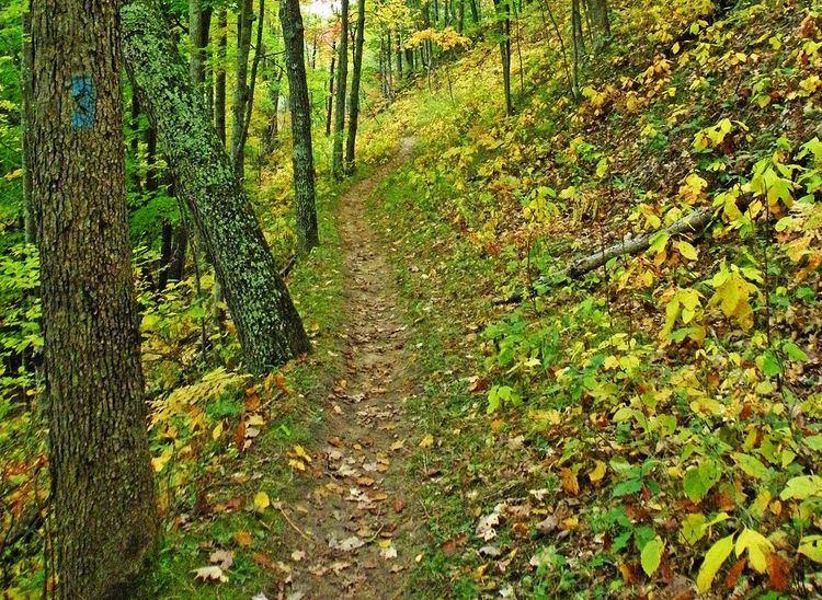 | ||
Sights Northern hardwood forest; prairie; agricultural fields; low mountains; sand dunes; boreal forest; lake shores; small towns. Hours Open today · 10AM–4:30PMFriday10AM–4:30PMSaturdayClosedSundayClosedMondayClosedTuesday1–4:30PMWednesday1–4:30PMThursday1–4:30PMSuggest an edit Designation National Scenic Trail (1980) Similar Continental Divide Trail, Superior Hiking Trail, Manistee River Trail, Porcupine Mountains, Border Route Trail Profiles | ||
North country trail wisconsin sections
The North Country National Scenic Trail, generally known as the North Country Trail or simply the N.C.T., is a footpath stretching approximately 4,600 miles (7,400 km) from Crown Point in eastern New York to Lake Sakakawea State Park in central North Dakota in the United States. Passing through the seven states of New York, Pennsylvania, Ohio, Michigan, Wisconsin, Minnesota, and North Dakota, it is the longest of the eleven National Scenic Trails authorized by Congress. As of early 2017, 3,009 miles (4,843 km) of the trail is in place.
Contents
- North country trail wisconsin sections
- Interview with strider north country trail thru hiker
- History
- Route
- Ohio
- Use
- References
The NCT is administered by the National Park Service, managed by federal, state, and local agencies, and built and maintained primarily by the volunteers of the North Country Trail Association (NCTA) and its partners. The 28 chapters of the NCTA, its 3,200+ members and each affiliate organization have assumed responsibility for trail construction and maintenance of a specific section of the NCT.
Interview with strider north country trail thru hiker
History
The NCT was created on March 5, 1980 by an amendment to the National Trails System Act. When the Trail was established in 1980, portions of it were designed to follow the already existing Finger Lakes (New York), Baker (Pennsylvania), and Buckeye (Ohio) Trails. Their sponsoring organizations became affiliates of the North Country Trail Association and agreed to maintain those portions of their trails to be used by the North Country National Scenic Trail. The Northwestern Ohio Rails-to-Trails Association joined later to help create a link between the Buckeye Trail in Ohio and newly constructed trail in Michigan; the Superior Hiking Trail Association and the Kekekabic Trail Club joined when it was proposed that the North Country National Scenic Trail route through Minnesota be changed to include an already-completed section of the Superior Hiking Trail along Lake Superior, and the Kekekabic and Border Route Trails along the Canada–US border in Minnesota's Arrowhead Region. Legislation has been introduced to both the U.S. House of Representatives and U.S. Senate which would authorize the "Arrowhead Re-route" as well as an extension to the trail's eastern terminus, connecting it with the Appalachian Trail in Vermont.
Route
The trail begins in northeast New York and proceeds to the western end of the state. It cuts across northwestern Pennsylvania, then follows a southwesterly course through the hilly region of southern Ohio until it nears Cincinnati when it runs north through western Ohio to the hills of SE Michigan. It continues from southeast Michigan through the western Lower Peninsula, crosses the Straits of Mackinac, and takes a northern route the length of the Upper Peninsula. After crossing northern Wisconsin, one leg follows the Lake Superior shore to the northeast corner of Minnesota before turning west, where it meets the other leg in central northern Minnesota. The trail enters southeast North Dakota, and continues to its other terminus in the center of the state.
The NCT connects more than 160 public land units, including parks, forests, scenic attractions, wildlife refuges, game areas, and historic sites. The list includes:
Other federal facilities along the NCT include:
The NCT also threads its way through 57 state parks and state historic areas, 47 state forests, 22 state game areas, seven state water conservation districts and at least ten county forests and parks. Several hundred miles of trail eventually will also cross private land thanks to owners who have granted easements across their property.
The center point of the trail is located near the NCTA headquarters in Lowell, Michigan.
Though the eastern terminus of the North Country Trail is only a few miles from Vermont's Long Trail and the Appalachian Trail, there is not yet a connecting trail to either of those trail systems. Efforts are under way to connect to the Appalachian Trail.
Ohio
Use
Existing and new sections of the NCT are generally limited to foot travel, including hiking, snowshoeing and cross-country skiing. Other non-motorized uses, such as bicycling and horseback riding are generally limited to areas specifically designed to withstand such use.
About 10,000 people are involved with the NCT in one way or another, either through membership in the North Country Trail Association or membership in one of eight organizations affiliated with the NCTA: the Finger Lakes Trail Conference, the Buckeye Trail Association, the Superior Hiking Trail Association, the Kekekabic Trail Club, the Northwestern Ohio Rails-to-Trails Association, the Butler Outdoor Club, the Rachael Carson Trails Conservancy and the Friends of the Jordan River National Fish Hatchery.