
Named for Lord Lansdowne Elevation 1,700 m | Established 1887 Time zone IST (UTC+5:30) Area 6.09 km² | |
 | ||
Weather 6°C, Wind N at 5 km/h, 67% Humidity Points of interest Tip in Top Point (Tiffin Point), Garhwali Mess, St Mary's Church | ||
Lansdowne (Hindi: लैंसडाउन) is a cantonment town in Pauri Garhwal district in the Indian state of Uttarakhand.
Contents
- Map of Lansdowne Uttarakhand 246155
- History
- Local attractions
- How to reach Lansdowne
- Geography
- Nearby places
- Demographics
- References
Map of Lansdowne, Uttarakhand 246155
History
Originally known as Kaludanda (Hindi: कालूडाण्डा) after Kalu (Black) and Danda (Hill) in Garhwali, Lansdowne was founded and named after then Viceroy of India (1888-1894), Lord Lansdowne in 1887, and by 1901 it had a population of 3943. Lansdowne was developed by the British for catering for the Recruits Training center of the Garhwal Rifles. Lansdowne was a major place of the activities of freedom fighters from British Garhwal during British period. Nowadays, the famous Garhwal Rifles of the Indian Army has its command office here. Lansdowne is one of the quietest hill stations of India and is popular since Britishers came to India. Lansdowne is unlike other hill stations as it is well connected with motorable roads but remote in its own way. It is situated at an altitude of 1,706 mts above sea level surrounded with thick oak and blue pine forests in the Pauri Garhwal district of Uttarakhand state.
On 5 November 1887, the first battalion of Garhwal Rifles migrated from Almora to Lansdowne. Lansdowne was the only city after Almora in the late 1870s. People of different culture and states came to do business in Lansdowne after it became popular. The buildings and church of Lansdowne built during British period, which dates back to the pre-independence period. Lansdowne is an ideal location for eco-tourism as it is well preserved by the Government of Uttarakhand and the Garhwal Rifles.
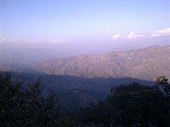
Local attractions
The War Memorial, at the Parade Ground of the Garhwal Rifles Center, is an attraction for the visitors. However, prior permission from the military authority has to be taken. Places of interest around the city include Tip n Top View Point, Kaleshwar Mahadev Temple, which is the most visited Hindu Temple in Lansdowne and is flocked by thousands of devotees during the month of Sawan ( Indian Monsoon ), Santoshi Mata Temple, Regimental Museum (also called the Darwan Singh Sanghralaya), Bhullatal Lake, St. Mary's Church, and Lover's lane. The excursions from the city are Tarkeshwar Mahadev Temple, Bhairav Garhi Temple, Bhim Pakora. The Annual ‘Sharadotsava’ (Festival of Autumn) is also organized at this hill station during autumn season. The old cemetery in Kitchner Lines is one of the more mysterious places and some even call it one of the most haunted places in lansdowne. Many war veterans have been laid to rest in the old cemetery and the graves are as old as 150 years.
The Garhwal Rifles regimental museum, also called Darwan Singh Sanghralaya, houses artefacts from the beginning of the Regiment. The Garhwal Rifles participated in the two world wars among countless other battles throughout its more than 100 years of history. All artifacts, including photographs, arms used by regimental commanders, captured weapons, campaign history and other information is displayed in this museum. There are many items, such as medals won by erstwhile Garhwal Rifle soldiers, that have been put on display, this includes the Victoria Cross awarded to Darwan Singh Negi and Gabar Singh Negi. Lansdowne is also famous for standard education.
How to reach Lansdowne
It is the nearest hill station from Delhi and can be reached from Delhi by either road or train. The nearest railway station is Kotdwar at a distance of 44 km situated an elevation of only 370 m. Since Lansdowne is more than 1,300 m higher than Kotdwara, the drive from Kotdwara to Lansdowne is quite steep and scenic. The nearest airport is Jolly Grant Airport, near Dehradun at a distance of 152 km via Kotdwar-Haridwar road. The other and better route to reach Lansdowne is from Delhi via Meerut, Bijnore, Najibabad, Kotdwar and on to Lansdowne. It saves about 50 km and the road quality is also good all the way to Kotdwar. One has to take a right turn from NH-119 at a place where The Garhwal Rifles has put a huge signboard by painting the directions on rocks. Lansdowne is 81 km from Pauri and about 250 km from Delhi. The drive through Blue Pine trees on hills near Lansdowne is a wonderful experience.
Geography
Lansdowne is located at 29.83°N 78.68°E / 29.83; 78.68. It has an average elevation of 1,706 metres (5,686 feet). Surrounded by thick oak and blue pine forests, Lansdowne has scenic beauty and good surroundings.
Nearby places
Famous Tarkeshwar Mahadev Temple with its special Shivalinga and a Kund (a small pond) known as Gauri Kund is situated 39 km away from Lansdowne. People take bath in Gauri Kund before entering the temple. Two other famous temples, Durga Devi Temple and Jwalpa Devi, which are on the Pauri-Kotdwar road are 24 km and 47 km away respectively. Durga Devi Temple is one of the oldest Siddha Pithas in India.
Kanvashram, a well-known landmark is situated 14 km from Kotdwar railway station. Shakuntala, wife of King Dushantya and deserted by him, is said to have given birth to Bharata in the Ashram of Rishi Kanva in ancient India. India got its name 'Bharat' in Sanskrit after Bharata became king following the death of his father.
Demographics
As of 2001 India census, Lansdowne had a population of 7902. Males constitute 64% of the population and females 36%. Lansdowne has an average literacy rate of 86%, higher than the national average of 74%: male literacy is 91%, and female literacy is 79%. In Lansdowne, 9% of the population is under 6 years of age.