
Country India Time zone IST (UTC+5:30) Area 5,399 km² | Vehicle registration UK | |
 | ||
Destinations Rishikesh, Jim Corbett National Park, Lansdowne, Devprayag, Rajaji National Park Points of interest Neelkanth Mahadev Temple, Jim Corbett National Park, Lakshman Jhula, Rajaji National Park, Tarkeshwar Mahadev | ||
Pauri Garhwal is a district in Uttarakhand state of India, with Pauri town as its headquarters.
Contents
- Map of Pauri Garhwal Uttarakhand
- History
- Geography
- Climate
- Demographics
- Administrative structure
- Education
- Economy
- Transport
- Tourism
- Khirsu
- Chaukhamba View Point
- Kandoliya Devta
- Danda Nagraja Temple
- Jwalpa Devi Temple
- Shoonya Shikhar Ashram
- Kyunkaleshwar Mahadev
- Tarkeshwar Mahadev
- Ekeshwar Mahadev
- Binsar Mahadev
- Doodhatoli
- Tarakund
- Kanvashram
- References
Map of Pauri Garhwal, Uttarakhand
History
The evolution of human civilization in this region of Garhwal Himalaya has paralleled that of the rest of the Indian sub-continent. The earliest historical dynasties were the Kunindas (before the 6th century A.D.) and the Katyuris (6th to 12th century A.D.), which ruled over unified Uttarakhand and left important records in the form of temples and inscriptions. After the downfall of the Katyuris, it is believed that the Garhwal region was fragmented into more than sixty-four principalities ruled by chieftains, one of the principal chieftainships being that of Chandpurgarh. In the middle of the 15th century A.D., Chandpurgarh emerged as a powerful principality under the rule of King Jagatpal (1455 to 1493 A.D.), who was a descendent of Kanakpal. Toward the end of 15th century A.D., King Ajaypal of Chandpurgarh ruled the entire region. Subsequently, his kingdom came to be known as Garhwal and he transferred his capital from Chandpur to Devalgarh before 1506 A.D. and later to Srinagar between 1506 and 1519 A.D.
King Ajaypal and his successors, the Pal (Shah) dynasty, ruled Garhwal for nearly three hundred years. During this period they faced a number of attacks from Kumaon, Mughals, Sikhs, and Rohillas. An important event in the history of Pauri Garhwal district was the Gorkha invasion. This invasion was marked by extreme brutality. After conquering Doti and Kumaon, Gorkhas attacked Garhwal and met stiff resistance from the Garhwali forces. Then news came of a Chinese invasion, and the Gorkhas were forced to lift the siege. In 1803, however, the Gorkhas again mounted an invasion. After capturing Kumaon, three columns attacked Garhwal. In 1804, the Gorkhas defeated the army of King Pradyumna Shah and became the masters of all of Garhwal. They ruled the territory for twelve years.
In 1816, at the end of the Anglo-Nepalese War and the defeat of the Gorkha army, the rule of the Gorkhas in Garhwal was ended by the British. On 21 April 1815, the British decided to establish their rule over the eastern half of Garhwal, lying east of the Alaknanda and Mandakini rivers. The remaining part of Garhwal in the west was returned to King Sudarshan Shah who established his capital at Tehri. Initially the administration was entrusted to the commissioner of Kumaon and Garhwal, with headquarters at Nainital, but later, in 1840, Garhwal was separated and formed into a separate district under an assistant commissioner with his headquarters at Pauri.
Geography
Located partly in the Gangetic plain and partly in the northern Himalayas, Pauri Garhwal district encompasses an area of 5,230 square kilometres (2,020 sq mi) and is situated between 29° 45’ to 30°15’ North Latitude and 78° 24’ to 79° 23’ East Longitude. The district is bordered on the southwest by Bijnor district, Uttar Pradesh, and, clockwise from west to southeast, by the Uttarakhand districts of Haridwar, Dehradun, Tehri Garhwal, Rudraprayag, Chamoli, Almora, and Nainital.
Climate
The climate of Pauri Garhwal is mostly pleasant in summer and cold in winter. In the rainy season the climate is cool and the landscape green. However, in Kotdwar and the adjoining Bhabar area, it is quite hot, reaching the high 40s Celsius during the summer. In the winter, many parts of Pauri receive snowfall.
Demographics
As of 2001 Indian census, the Pauri Garhwal district had a population of 697,078, with a religious breakdown of 673,471 Hindus, 20,157 Muslims (2.89%), and 1,915 Christians.
According to the 2011 census, Pauri Garhwal district has a population of 686,527, which is almost equal to the 2014 population of Equatorial Guinea, and to the US state of North Dakota. This gives it a ranking of 506th in India (out of a total of 640). The district has a population density of 129 inhabitants per square kilometre (330/sq mi). Its population growth rate over the decade of 2001-2011 was -1.51%. Pauri Garhwal has a sex ratio of 1103 females for every 1000 males, and a literacy rate of 82.02%.
Administrative structure
In 1960, what was known as Garhwal district was divided into Pauri Garhwal and Chamoli districts. In 1997, an additional area was carved out of Pauri Garhwal district and merged with parts of Chamoli and Tehri Garhwal districts to form Rudraprayag district.
The District is administratively divided into nine tehsils and fifteen developmental blocks.[1]
Education
Pauri, Kotdwar, Lansdowne and Srinagar are major centres of education in the district. Govind Ballabh Pant Engineering College is at Ghurdauri (11.5 kilometres (7.1 mi) from Pauri). Hemwati Nandan Bahuguna Garhwal University, Veer Chandra Singh Garhwali Government Medical College, and National Institute of Technology Uttarakhand are in Srinagar.
Economy
The main occupation is agriculture, but some large and small industrial units have been established around Kotdwara, promoted by the State Industrial Development Corporation of Uttarakhand (SIDCUL). Due to geography and the lack of infrastructure, there are no major industries in the hilly part of the district. The army and para-military forces are a major source of employment for young people.
Major companies working in the region are steelmaker Shree Sidhbali Industries, information technology company Wipro Ltd, pharmaceutical company Simpex Pharma and Ayurvedic medicine supplier Sri Sri Ayurveda. Organic farming company Banjosh Enterprises has the first integrated mushroom growing plant in Pauri Garhwal at Sigaddi with an installed capacity of 700 MT per annum.
Transport
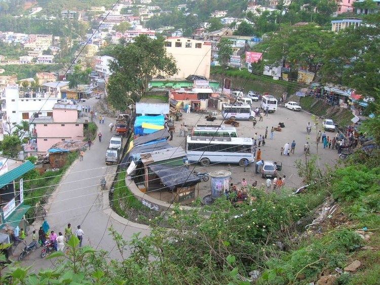
The most common mode of transport is by either bus or taxi. Bus services are provided by the state-run Uttarakhand Roadways, Garhwal Motor Owner Union (GMOU) Ltd., and Garhwal Motor Users (GMU) Ltd. Operations of Uttarakhand Roadways are limited mainly to interstate routes and major cities and towns of the district and state. GMOU Ltd. is the largest bus service provider in the district, providing services to almost all parts of the district. The services of GMU Ltd. are limited to a comparatively small area adjoining Kumaon division. There are a number of taxi unions in many towns of the district, providing service for almost every local stretch of road.
A new road is under construction currently in Andkil village, which will connect this tiny village to the main Kotdwar road via Ekeshwar, and will give a scenic view of the Garhwal Himalayas to the north.
The only railway station in the district is at Kotdwara. It was established by the British as early as 1889. Pauri Garhwal district is situated in the Shiwalik range, the outermost range of the Himalayas, and its hills are very rugged. As a result, it is not considered feasible to extend the railway network further.
The district does not have any regular air services. The nearest is Jolly Grant Airport, near the state capital of Dehradun, about 155 kilometres (96 mi) from Pauri and 120 kilometres (75 mi) from Kotdwara.
Tourism
Tourism in Pauri Garhwal District includes a number of exploring options. Pauri Garhwal is considered nature's paradise and attracts people through its charm and magnificence. The beautiful valleys, snow clad mountain peaks, and amazing features of nature are key components that attract travellers. Moreover, tourism in Pauri will be considered incomplete without paying a visit to its ancient temples.
Khirsu
The mountains of Khirsu offer a panoramic view of the northern Himalayas and attract a large number of tourists. From here one can get a clear view of many named and unnamed peaks. Located 19 kilometres (12 mi) away from Pauri at an altitude of 1,700 metres (5,600 ft), Khirsu is peaceful and free from pollution. Only the chirping of birds breaks the tranquility of the adjoining thick oak and deodar forests and apple orchards. There is the nearby ancient temple of Ghandiyal Devta. Accommodation is available at the Tourist Rest House, Forest Rest House, and private hotel.
On the 4th Monday of April or 1st Monday of May, there is an annual Mela put on by local villagers.
The villages of Gwarh and Khothgee, near Khirshu, have a festival where they lower an artificial carved wooden effigy of man, called "Badi" by locals, by rope down a hill for about 500 meters.
Chaukhamba View Point
Situated only 4 km from Pauri. Chaukhamba View Point overlooks the Idwal Valley, with views of the Chaukhamba peaks. It is known for its scenic vistas.
Kandoliya Devta
The main temples of the city are Kandoliya Devta, Laxmi Narayan, Kyunkaleshwar Mahadev, and Hanuman Mandir. Every year, a bhandara is organized on the premises of the temple of Kandoliya Devta, and thousands of people from Pauri and nearby villages participate in it. The city has a number of scenic picnic spots surrounded by deodar forests, viz. Ransi, Kandoliya, Nag Dev, Jhandi Dhar, etc. Every year since 1974, Sharadotsav is celebrated in the city.
Danda Nagraja Temple
The holy shrine of Danda Nagraja is a popular pilgrimage among the Garhwali people. Garhwalis from around the country visit the shrine every day. It is located in the Lasera village, patti Banelsyun, Pauri district (lap of mountains). The temple gets its name from the Garhwali word Danda, which means "peak". Since the temple is in a forest, local people started calling it Danda Nagraja - "Nagraja on the Peak".
Legend has it that when Lord Krishna came here for the first time, he came in the form of a snake and crawled all the way up the ridge to reach the spot where the temple now stands. Locals have a strong belief that Lord Krishna still stays here and has done so over many centuries. They say they receive the special blessings of Danda Nagraja. Popular faith is that Danda Nagraja has the power to foresee any ill coming to the area and always informs them about any mishap that is about to occur. Not just that, locals say the Lord also gives them the solution to the problem. The temple’s high priest tells you with conviction that if any devotee prays sincerely, Danda Nagraja always fulfills his wishes. In part because of this temple, Pauri Garhwal is known as a "Land of Miracles".
A feature of this temple is the thousands of bells that have been hung in the temple premises by devotees after their wishes were fulfilled. There is also a custom of devotees offering jaggery (gurh) as prasad (offering) to the reigning deity. After a darshan (vision) of श्री डांडानागराजा (Shri Danda Nagraja), the pilgrims take a parikrama (ritual walkabout) of the temple to get the blessings of the God.
"The temple not only attracts local people but, every year, many foreigners come visiting and they donate bells with their names written all over. The main visitors are from the US and UK," the priest tells you.
Danda Nagraja is approximately 90 kilometres (56 mi) from Kotdwara, 45 kilometres (28 mi) from Satpuli, and 35 kilometres (22 mi) from Pauri. The temple is situated at the top of a hill with ample space around the structure for pilgrims to relax. It can be reached by taking a bus either from Kotdwara or Pauri. However, bus service is limited, with usually no more than two buses on a route. So, the better option is to hire a taxi.
Jwalpa Devi Temple
This is a famous Shakti Peetha of Garhwal dedicated to the Goddess Jwalpa. It is situated on the right bank of the Nawalika River (nayar), 34 kilometres (21 mi) from Pauri, on the main Pauri-Kotdwara road. According to a legend in the Skanda Purana, Sachi (daughter of the demon king Pulom) wanted to marry devraj Indra, so she worshipped the supreme mother Goddess Shakti here. The Goddess then appeared in the form of Deeptimaan Jwalehwari and her wish was fulfilled. Deeptimaan Jwalehwari was eventually shortened to Jwalpa Devi. It is said that Adi Guru Shankaracharya visited and prayed in this temple, and that the Goddess appeared to him. Every year two Navratri fairs are held: Chitra and Shardiya Navratri. The Anthwal family are the traditional priests and caretakers of this temple, as the present temple was constructed by the late Pandit Shri Dutta Ram Anthwal (the Anthwals, originally from village Aneth, being the zameendaar, or landlords, of the area). Every year thousands of people visit this temple, especially unmarried girls, as it is said that the girls get fine grooms just like Indrani (Shachi) got Lord Indra by the grace of The Goddess.
Shoonya Shikhar Ashram
This is a spiritual center near Kotdwara. One can reach it by 7 km of trekking from village Balli, which is itself around 30 km uphill from Kotdwara. Shoonya Shikar Ashram is known for the meditation cave of Sadguru Sadafaldeo Ji Maharaj. This is the place where Swarved was written. It attracts people from all over the world, in particular the followers of Vihangam Yoga, who seek high-level meditation.
Kyunkaleshwar Mahadev
Situated in the suburbs of Pauri, with scenic views of the snow-laden Himalayas, Kyunkaleshwar Mahadev is an 8th-century temple dedicated to Lord Shiva, the presiding deity, who is accompanied by Goddess Parvati, Ganesha, and Kartikeya.
Tarkeshwar Mahadev
36 km from Lansdowne, at a height of 1,800 m, this place is known for its temple dedicated to Lord Shiva. Surrounded by thick forests of deodar and pine, it is a place of natural beauty. During Shivratri, and in the month of May, special worships are held. The temple committee provides a dharamshala for accommodations.
Tarkeshwar Dham is 5 km from Chakhuliyakhal and 20 km from Rikhnikhal.
Ekeshwar Mahadev
26 km from Satpuli, at a height of 1,820 m, this place is a sidhpeeth dedicated to Lord Shiva, with scenic views and a calm climate. During Shivratri, a special worship is held. The road from Satpuli to Ekeshwar offers views of the snow-covered Chaukhmba peaks.
Binsar Mahadev
Amidst dense forests of birch, rhododendron, and deodar, is the temple of Binsar Mahadev, at an altitude of 2480 m and a distance of 114 km from Pauri. The sanctuary of the temple houses the deities Hargauri, Ganesh and Mahisasurmardini. The temple is believed to have been constructed by Maharaja Prithu in memory of his father Bindu, so is also known as Bindeshwar Temple. A big fair takes place here on the occasion of Baikunth Chaturdashi, every year. The nearest town is Thalisain, about 25 km by road and about 4–5 km by trekking overland.
Doodhatoli
Doodhatoli, at an altitude of 3100 m, is covered with dense mixed forest. Thalisain, 104 km. from Pauri, is the last bus stop, from where Doodhatoli is 24 km distant by trek. It picturesque and offers a panoramic view of the Himalayas.
Tarakund
Situated at a height of 2200 m, Tarakund is a small picturesque spot amidst lofty mountains in the Chariserh Development Area. A small lake and an ancient temple adorn the place. The Teej festival is celebrated with great gaiety when the local people come here to worship and pay homage to God. On the occasion of Shivratri, local people go Tara Kund to worship Lord Shiva.
The distance from the main road to Tarakund is about 8 km. Palli is the nearest village.
Kanvashram
Kanvashram is an important destination from an historical and archaeological point of view.
According to legend, this is the place where the great sage Swami Vishvamitra meditated and Indra, fearing Vishwamitra’s intense meditation, sent a charming heavenly damsel Menaka to distract him. Menaka succeeded in seducing, and thus distracting, the sage. A daughter named Shakuntala was born as the fruit of their union. She was then left in the ashram, in the care of Rishi Kanva. Shakuntala later, upon marriage with Dushyant, the ruler of Hastinapur, gave birth to prince Bharat. It is by virtue of this name - Bharat - that India came to be called Bharatvarsha and thus Bharat.
Kanvashram has much to offer visitors. Those seeking solitude can relax amidst forested surroundings of Kanvashram, while a number of long and short trekking routes are there to satisfy the adventurous. For a long hike, one can reach scenic Sahastradhara Falls after a one-hour trek. For those unwilling to make any tiring walk, a short walk to Malini Barrage is available.
There is also a Gurukul that one can visit. This Gurukul – a traditional school for boys – provides services like massages and conducts courses in yoga, besides making available a host of ayurvedic medicines.
Comfortable boarding and lodging facilities are available in Kanvashram. One can stay at the Gurukul, or one can spend the night at the GMVN tourist rest house.
Kanvashram is well-connected by road with the region. The nearest railhead is at Kotdwara which is 14 km away while the nearest airport is Jolly Grant at Dehradun.