
Type Natural Max depth 86 m Area 18.7 km² Province Québec | Primary inflows Surface elevation 161 m Catchment area 586 km² | |
 | ||
Max. length 14.2 kilometres (8.8 mi) | ||
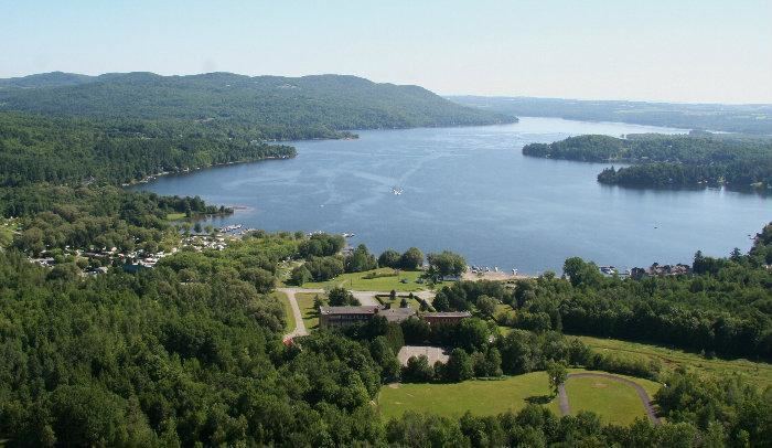
North hatley lake massawippi quebec best spot in canada
Lake Massawippi is a freshwater lake in Memphrémagog Regional County Municipality in the Estrie region of Quebec, Canada. The Tomifobia River is the source of the lake at its southern tip, near the village of Ayer's Cliff, Quebec. In early records, the lake was also called "Lake Tomifobi". The current of the lake flows north, funneling into the Massawippi River at the village of North Hatley, Quebec on Massawippi's northern shore.
Contents
- North hatley lake massawippi quebec best spot in canada
- Map of Lac Massawippi QuC3A9bec Canada
- Fishing grey trout lake massawippi p che de la truite grise au qu bec
- LeisureEdit
- References
Map of Lac Massawippi, Qu%C3%A9bec, Canada
It is bordered by five municipalities: North Hatley, Hatley Township, the municipality of Hatley, Ayer's Cliff and Sainte-Catherine-de-Hatley.
Massawippi is an Abenaki word that translates to "the big deep lake" in English.
Fishing grey trout lake massawippi p che de la truite grise au qu bec
LeisureEdit
A popular summer destination for wealthy Americans in the late-19th and early-20th centuries, industrialist Foxhall P. Keene, writer Upton Sinclair, and the Barron family (of Barron's Magazine) were among those who owned seasonal estates on the lake.
Today Lake Massawippi is the site of two luxury hotels — Hovey Manor and the Ripplecove Inn.
In 2003, French President Jacques Chirac spent his summer holiday on the lake at the Hatley Inn, a luxury hotel renowned for its gastronomy that has since burnt down.