
Max. width 2.5 mi (4.0 km) Length 23 km Width 4 km Shore length 55.28 km | Max. length 14 mi (23 km) Area 54.15 km² Surface elevation 395 m Mean depth 5.33 m Cities Bergland | |
 | ||
Primary inflows Primary outflows West Branch of Ontonagon River | ||
Ice fishing 2015 jumbo perch lake gogebic hog a thon
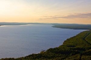
Lake Gogebic (/ɡoʊˈɡɪ.bɪk/ go-GI-bik) is the largest natural lake of the Upper Peninsula of Michigan. It is located within the one million acre (4,000 km²) Ottawa National Forest. Lake Gogebic State Park is located along its western shore.
Contents
- Ice fishing 2015 jumbo perch lake gogebic hog a thon
- Map of Lake Gogebic Michigan USA
- Larry smith outdoors lake gogebic walleyes on ice
- References
Map of Lake Gogebic, Michigan, USA
It is in the far western end of the Upper Peninsula, close to the Wisconsin border, and in parts of two counties, Gogebic County and Ontonagon County. The lake is also in two time zones, central and eastern.
Though the lake is a natural body of water, the level is regulated by the Upper Peninsula Power Company through its Bergland Dam located downstream on the West Branch of the Ontonagon River.
In 2005 a state Department of Natural Resources survey found Black bullhead, Black crappie, Brown bullhead, Burbot, Cisco, Common shiner, Creek chub, Golden shiner, Northern pike, Pumpkinseed, Rock bass, Smallmouth bass, Walleye, White sucker, and Yellow perch in the lake.