
Founded 1887 Website www.gogebic.org Population 15,916 (2013) Unemployment rate 7.4% (Apr 2015) | Area 3,823 km² University Gogebic Community College | |
 | ||
Points of interest Copper Peak, ABR Active Backwoods Retreat, Lake Gogebic State Park, Manabezho Falls, Manido Falls Destinations | ||
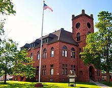
Gogebic County (/ɡoʊˈɡɪ.bɪk/ go-GI-bik) is the westernmost county in the Upper Peninsula in the U.S. state of Michigan. As of the 2010 census, the population was 16,427. The county seat is Bessemer. This was historically part of the territory of the Lake Superior Band of Chippewa, which had twelve bands in Michigan, Wisconsin and Minnesota. The Lac Vieux Desert Indian Reservation is in this county, in Watersmeet Township, as the land base of one of the federally recognized tribes.
Contents
- Map of Gogebic County MI USA
- Geography
- Water features
- Adjacent counties
- National protected area
- State protected area
- Demographics
- Government
- Major highways
- Airport
- Cities
- Townships
- Census designated places
- Other unincorporated communities
- References
Map of Gogebic County, MI, USA
The county was set off and organized in 1887. It had been part of Ontonagon County. The name is said to be derived from the Ojibwe word bic, which most references interpret as "rock." Alternatively, it is claimed to be derived from Lake Agogebic, later changed to Lake Gogebic, which was also derived from an Ojibwe word. See List of Michigan county name etymologies.
Geography
According to the U.S. Census Bureau, the county has a total area of 1,476 square miles (3,820 km2), of which 1,102 square miles (2,850 km2) is land and 374 square miles (970 km2) (25%) is water.
Water features
Adjacent counties
National protected area
State protected area
Demographics
The 2010 United States Census indicates Gogebic County had a population of 16,427. This is a decrease of 943 people from the 2000 United States Census. This is a -5.4% change in population. In 2010 there were 7,037 households and 4,171 families residing in the county. The population density was 15 people per square mile (6/km²). There were 10,795 housing units at an average density of 10 per square mile (4/km²). 91.7% of the population were White, 4.1% Black or African American, 2.4% Native American, 0.2% Asian, 0.2% of some other race and 1.4% of two or more races. 0.9% were Hispanic or Latino (of any race). 17.4% were of Finnish, 12.8% German, 11.2% American, 10.0% Italian, 6.8% Polish, 6.7% English and 5.1% Irish ancestry.
There were 7,037 households out of which 20.6% had children under the age of 18 living with them, 45.4% were married couples living together, 9.3% had a female householder with no husband present, and 40.7% were non-families. 35.3% of all households were made up of individuals and 16.5% had someone living alone who was 65 years of age or older. The average household size was 2.11 and the average family size was 2.69.
In the county, the population was spread out with 16.9% under the age of 18, 8.4% from 18 to 24, 22.2% from 25 to 44, 31.1% from 45 to 64, and 21.5% who were 65 years of age or older. The median age was 46.8 years. 53.3% of the population was male, and 46.7% of the population was female.
The median income for a household in the county was $34,917, and the median income for a family was $47,219. The per capita income for the county was $20,759. About 14.0% of families and 17.2% of the population were below the poverty line, including 28.6% of those under age 18 and 9.0% of those age 65 or over.
Government
The county government operates the jail, maintains rural roads, operates the major local courts, maintains vital records and property records, administers public health regulations, and participates with the state in the provision of welfare and other social services. The county board of commissioners controls the budget but has limited authority to make laws or ordinances. In Michigan, most local government functions — police and fire, building and zoning, tax assessment, street maintenance, etc. — are the responsibility of individual cities and townships.
Major highways
Bus. US 2 serves the city of Ironwood.
Airport
Commercial air service is available at Gogebic-Iron County Airport (KIWD), located (7) miles northeast of Ironwood.