
 | ||
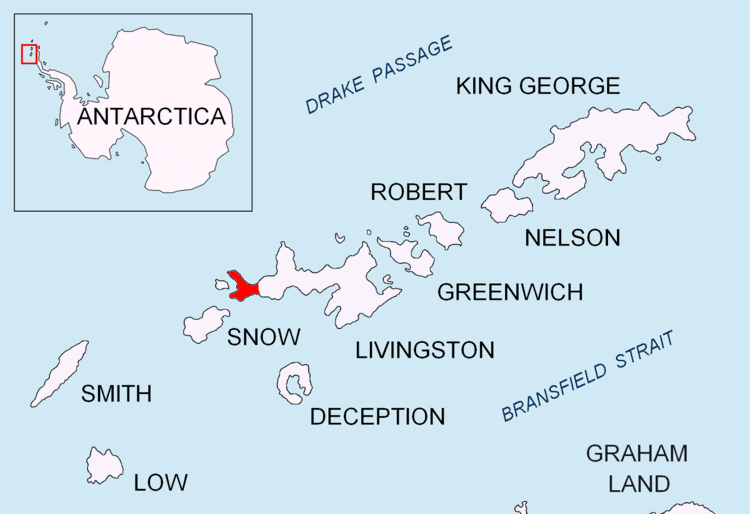
Laager Point is a conspicuous headland extending out from President Beaches on Byers Peninsula, Livingston Island in the South Shetland Islands, Antarctica and forming a southeast entrance point for New Plymouth harbour and a northeast entrance point for Osogovo Bay. The area was visited by 19th century sealers.
Contents
The feature’s name (meaning ‘Camp Point’) derives from an earlier Spanish form, ‘’Punta Campamento’’, given by Chilean researchers in 1971.
Location
The point is located at 62°38′16.1″S 61°08′55.2″W which is 6.45 km south-southeast of Start Point, 3.28 km west of Chester Cone, 4.9 km northwest of Nikopol Point, 4.09 km north-northeast of Devils Point and 2.14 km east-southeast of Vund Point, Rugged Island (British mapping in 1968, detailed Spanish mapping in 1992, and Bulgarian mapping in 2005 and 2009).