
Website www.lagrangecounty.org Founded 1832 Unemployment rate 3.4% (Apr 2015) | Area 1,002 km² Population 37,996 (2013) | |
 | ||
Rivers Pigeon River, Fawn River, Little Elkhart Creek Points of interest Dallas Lake Park, Dutch Creek Farm Ani, Hostetler's Hudson Auto Mus, Corn School, Maple Wood Nature C | ||
Quality of life in lagrange county indiana
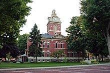
LaGrange County is a county located in the U.S. state of Indiana. As of 2010, the population was 37,128. The county seat is LaGrange, Indiana.
Contents
- Quality of life in lagrange county indiana
- Map of Lagrange County IN USA
- History
- Geography
- Adjacent counties
- Major highways
- Towns
- Census designated place
- Economy
- Climate and weather
- Government
- Demographics
- Education
- Public schools
- Private schools
- References
Map of Lagrange County, IN, USA
The county is located in the Northern Indiana region known as Michiana and is about 55 miles (89 km) east of South Bend, 105 miles (169 km) west of Toledo, Ohio, and 175 miles (282 km) northeast of Indianapolis. The area is well known for its large Amish population. For that reason, the county teams up with neighboring Elkhart County to promote tourism by referring to the area as Northern Indiana Amish Country.
History
The first settlement of LaGrange County was founded about a half mile west of Lima in 1828. Over the next four years, settlers flocked to parts of Lima, Springfield, and Van Buren Townships. Finally in 1832, LaGrange County was carved out of neighboring Elkhart County and established with Lima as the county seat. The town of LaGrange was platted in 1836 and settled in 1842 as the new county seat, closer to the center of the county. Lima's name was changed to Howe in 1909. LaGrange was laid out and platted in 1836.
LaGrange County's initial settlers were Yankee immigrants, that is to say they were from New England and were descended from the English Puritans who settled that region in the colonial era. They were part of a wave of New England settlers moving west into what was then the Northwest Territory after the completion of the Erie Canal. The original settlers in LaPorte County specifically hailed from the Massachusetts counties of Worcester County, Suffolk County and Berkshire County; the Connecticut counties of Hartford County and Windham County as well as the Connecticut towns of Sherman, Lebanon and Fairfield; and from the Vermont towns of Burlington, Brookfield, Huntington and Grand Isle. They were mainly members of the Congregational Church, but as a result of the Second Great Awakening many became Baptists and many also converted to Pentecostalism and Methodism. When they arrived in what is now LaGrange County, there was nothing but virgin forest and wild prairie, the New England settlers cleared roads, built farms, constructed churches, erected government buildings, and established post routes. As a result of this migration, LaGrange County was culturally continuous with early New England culture for many years.
In 1837, the government removed Chief Shipshewana and the Potawatomi Tribe from the northwest corner of the county. Several years later the Chief was allowed to return and died in Newbury Township in 1841. A town named Georgetown had been platted in 1837 but was abandoned because of lack of development. In 1844, the first Amish came from Pennsylvania to settle around the old town. The village continued to grow and the town of Shipshewana was platted nearby in 1899 and incorporated in 1916 in Newbury Township.
LaGrange County was named after the home of Revolutionary War hero, the Marquis de la Fayette, outside of Paris, France.
Geography
According to the 2010 census, the county has a total area of 386.70 square miles (1,001.5 km2), of which 379.62 square miles (983.2 km2) (or 98.17%) is land and 7.08 square miles (18.3 km2) (or 1.83%) is water.
The county is mostly made up of rural farm land but also some rolling hills and several lakes.
Adjacent counties
Major highways
Towns
Census-designated place
Economy
The economy is based mainly on agriculture and small shops but tourism also plays a big role, especially in Shipshewana.
Climate and weather
In recent years, average temperatures in Lagrange have ranged from a low of 14 °F (−10 °C) in January to a high of 82 °F (28 °C) in July, although a record low of −28 °F (−33 °C) was recorded in December 2000 and a record high of 104 °F (40 °C) was recorded in June 1988. Average monthly precipitation ranged from 1.76 inches (45 mm) in February to 4.17 inches (106 mm) in June.
Government
The county is led by a board of three elected commissioners that serve as the executive branch of county government. The county council is made of 7 elected members - four from each council district and 3 at large. Also, one assessor serves the entire county as opposed to one for every township.
The current county commissioners are:
The current county council members are:
Charles F. Ashcraft D - District 1
George Bachman R- District 2
Harold Gingerich R - District 3
Peter Cook R - District 4
Ben Taylor R - at large
Steve McKowen R - at large
Mike Strawser R - at large
Accurate as of December 2015.
LaGrange County is part of Indiana's 3rd congressional district; Indiana Senate district 13; and Indiana House of Representatives districts 18 and 52.
Demographics
As of the 2010 United States Census, there were 37,128 people, 11,598 households, and 9,106 families residing in the county. The population density was 97.8 inhabitants per square mile (37.8/km2). There were 14,094 housing units at an average density of 37.1 per square mile (14.3/km2). The racial makeup of the county was 96.6% white, 0.3% black or African American, 0.3% Asian, 0.2% American Indian, 1.7% from other races, and 0.8% from two or more races. Those of Hispanic or Latino origin made up 3.5% of the population. In terms of ancestry, 36.1% were German, 13.3% were American, 6.4% were Irish, and 6.4% were English.
Of the 11,598 households, 40.2% had children under the age of 18 living with them, 67.6% were married couples living together, 7.1% had a female householder with no husband present, 21.5% were non-families, and 18.4% of all households were made up of individuals. The average household size was 3.17 and the average family size was 3.66. The median age was 30.4 years.
The median income for a household in the county was $47,697 and the median income for a family was $53,793. Males had a median income of $40,960 versus $29,193 for females. The per capita income for the county was $18,388. About 12.1% of families and 16.0% of the population were below the poverty line, including 23.5% of those under age 18 and 16.6% of those age 65 or over.
Approximately 37% of the population of LaGrange County is Amish, and the county is home to the third largest Amish community in the United States and to the Elkhart-LaGrange Amish affiliation. This is reflected in the linguistic situation in the county: 28.45% of the population report speaking German, Pennsylvania German, or Dutch at home. A further 2.85% speak Spanish. 68.5% of the total population and 61.29% of the children in 5-17 age group used English as their home language, according to 2000 Census. The Amish languages (German, Pennsylfaansch and Dutch) were used by 28.47% of the total population and 35.77% of the children. [2]
Education
The county has three public school districts and the Howe Military School.
Public schools
The Lakeland Community Schools serve the central part of the county. The system includes three elementary schools (Lima-Brighton, Parkside, and Wolcott Mills), one middle school, and one high school both named Lakeland.
The Prairie Heights School Corporation serves the east side of the county as well as parts of Steuben County. The mascot of Prairie Heights School is a black panther. The Westview School Corporation serves the west portion of the county. This system consists of four elementary schools (Meadowview, Shipshewana-Scott, Topeka, and Westview), and one junior-senior high school named Westview.
Private schools
In addition to the public schools, Howe Military School exists in Howe and several Amish schools are located across the county.