
Congressional district 7th Website co.branch.mi.us Founded 1829 | Area 1,347 km² Population 43,649 (2013) | |
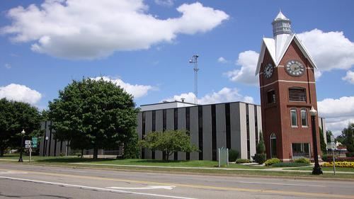 | ||
University Baker College of Coldwater Points of interest Coldwater Lake State Park, Adventure Zone, Wing House Museum, Little River Railroad, Branch County Memorial Destinations | ||
Branch County is a county in the U.S. state of Michigan. As of the 2010 census, the population was 45,248. The county seat is Coldwater. As one of the "cabinet counties" it was named for the U.S. Secretary of the Navy John Branch under President Andrew Jackson. The county was founded in 1829 and organized in 1833.
Contents
- Map of Branch County MI USA
- History
- Geography
- Adjacent counties
- Major highways
- Demographics
- Government
- Elected officials
- Cities
- Villages
- References
Map of Branch County, MI, USA
Branch County comprises the Coldwater, MI Micropolitan Statistical Area.
History
Branch County was a New England settlement. The original founders of Coldwater consisted entirely of settlers from New England. These people were "Yankees", that is to say they were descended from the English Puritans who settled New England in the 1600s and carried their culture with them. During the early 1800s, these settlers were part of a wave of New England farmers who headed west into what was then the wilds of the Northwest Territory. Many traveled through New York State via the Erie Canal; the threat of Native Americans had been reduced by the end of the Black Hawk War. When they arrived in what is now Branch County, they found virgin forest and wild prairie.
The Yankees laid out farms, constructed roads, erected government buildings, and established post routes. They brought many of their New England values, such as a passion for education, and established many schools. Many were supporters of abolitionism. They were mostly members of the Congregationalist Church though some were Episcopalian. Culturally Branch County, like much of Michigan, developed as part of the Northern Tier, continuous with New England culture, for most of its history. The county depends on agriculture as the basis of its economy.
Geography
According to the U.S. Census Bureau, the county has a total area of 520 square miles (1,300 km2), of which 506 square miles (1,310 km2) is land and 13 square miles (34 km2) (2.6%) is water. It is the third-smallest county in Michigan by total area.
Adjacent counties
Major highways
Demographics
The 2010 United States Census indicates Branch County had a 2010 population of 45,248. This is a decrease of -539 people from the 2000 United States Census. Overall, the county had a -1.2% growth rate during this ten-year period. In 2010 there were 16,419 households and 11,350 families in the county. The population density was 89.4 per square mile (34.5 square kilometers). There were 20,841 housing units at an average density of 41.2 per square mile (15.9 square kilometers). The racial and ethnic makeup of the county was 90.9% White, 3.0% Black or African American, 0.4% Native American, 0.4% Asian, 4.0% Hispanic or Latino, 0.1% from other races, and 1.2% from two or more races.
There were 16,419 households out of which 31.5% had children under the age of 18 living with them, 52.2% were husband and wife families, 11.1% had a female householder with no husband present, 30.9% were non-families, and 25.8% were made up of individuals. The average household size was 2.56 and the average family size was 3.05.
In the county, the population was spread out with 23.9% under age of 18, 8.0% from 18 to 24, 25.0% from 25 to 44, 28.3% from 45 to 64, and 14.7% who were 65 years of age or older. The median age was 40 years. For every 100 females there were 111.4 males. For every 100 females age 18 and over, there were 112.9 males.
The 2010 American Community Survey 3-year estimate indicates the median income for a household in the county was $41,855 and the median income for a family was $48,959. Males had a median income of $25,595 versus $17,263 for females. The per capita income for the county was $18,289. About 2.5% of families and 17.7% of the population were below the poverty line, including 25.3% of those under the age 18 and 9.0% of those age 65 or over.
Government
The county government operates the jail, maintains rural roads, operates the major local courts, keeps files of deeds and mortgages, maintains vital records, administers public health regulations, and participates with the state in the provision of welfare and other social services. The county board of commissioners controls the budget but has only limited authority to make laws or ordinances. In Michigan, most local government functions — police and fire, building and zoning, tax assessment, street maintenance, etc. — are the responsibility of individual cities and townships.