
GNIS feature ID 436547 Zip code 46746 | State Indiana Elevation 268 m Local time Wednesday 2:47 PM | |
 | ||
Weather -2°C, Wind NW at 21 km/h, 61% Humidity | ||
Howe is a small unincorporated census-designated place in Lima Township, LaGrange County, Indiana.
Contents
Map of Howe, IN 46746, USA
History
Howe was settled in 1834. At that time, it was named Mongoquinong, a name that the Potawatomi Indians had given to the prairie in northeastern Indiana. Shortly thereafter it was renamed Lima and was, at that time, the county seat. It was later renamed Howe after John B. Howe, a local attorney.
The Howe Military School, the town's most famous attraction, was founded in 1884.
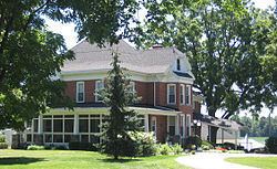
Local Places on the National Register
Sites in Howe on the National Register of Historic Places are:
Geography
Howe is located at 41°43′17″N 85°25′14″W at the intersection of State Road 120 and State Road 9. It is approximately three miles south of the IN US 80/90 toll road and five miles north of LaGrange.
References
Howe, Indiana Wikipedia(Text) CC BY-SA