
Founded 1668 Area 1,942 km² Unemployment rate 6.1% (Apr 2015) | Population 898,272 (2013) | |
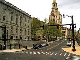 | ||
Points of interest Mark Twain House, Wadsworth Atheneum Colleges and Universities University of Hartford, Central Connecticut State Uni, Trinity College, University of Saint Joseph, University of Connecti Destinations | ||
Hartford County is a county located in the north central part of the U.S. state of Connecticut. As of the 2010 census, the population was 894,014, making it the second-most populous county in Connecticut.
Contents
- Map of Hartford County CT USA
- History
- Geography
- Adjacent counties
- 2000 census
- 2010 census
- Income
- Race
- Major highways
- Public Transportation
- Cities
- References
Map of Hartford County, CT, USA
Hartford County is included in the Hartford-West Hartford-East Hartford, CT Metropolitan Statistical Area.
In Connecticut there is no county-level executive or legislative government; the counties determine probate, civil and criminal court boundaries, but little else. Each city or town is responsible for local services such as schools, snow removal, sewers, fire department and police departments. In Connecticut, cities and towns may agree to jointly provide services or establish a regional school system.
History
Hartford County was one of four original counties in Connecticut established on May 10, 1666, by an act of the Connecticut General Court. The act establishing the county states:
This Court orders that the Townes on the River from yenorth bounds of Windsor wth Farmington to ye south end ofye bounds of Thirty Miles Island shalbe & remaine to be oneCounty wch shalbe called the County of Hartford. And itis ordered that the County Court shalbe kept at Hartford onthe 1st Thursday in March and on the first Thursday in September yearely.As established in 1666, Hartford County consisted of the towns of Windsor, Wethersfield, Hartford, Farmington, and Middletown. The "Thirty Miles Island" referred to in the constituting Act was incorporated as the town of Haddam in 1668. In 1670, the town of Simsbury was established, extending Hartford County to the Massachusetts border. In the late 17th to early 18th centuries, several more towns were established and added to Hartford County: Waterbury in 1686 (transferred to New Haven County in 1728), Windham in 1694 (transferred to Windham County in 1726), Hebron in 1708 (transferred to Tolland County in 1785), Coventry in 1712 (transferred to Windham County in 1726), and Litchfield in 1722 (transferred to Litchfield County in 1751).
In 1714, all of the unincorporated territory north of the towns of Coventry and Windham in northeastern Connecticut to the Massachusetts border were placed under the jurisdiction of Hartford County. Windham County was constituted in 1726, resulting in Hartford County losing the towns of Windham, Coventry, Mansfield (incorporated in 1702), and Ashford (incorporated in 1714). Northwestern Connecticut, which was originally placed under the jurisdiction of New Haven County in 1722, was transferred to Hartford County by 1738. All of northwestern Connecticut was later constituted as the new Litchfield County in 1751. In 1785, two more counties were established in what was now the U.S. state of Connecticut: Tolland and Middlesex. This mostly resulted in the modern extent of Hartford County. In the late 18th and early 19th centuries, the establishment of several more towns resulted in minor adjustments in the bounds of the county. The final adjustment resulting in the modern limits occurred on May 8, 1806, when the town of Canton was established.
Geography
According to the U.S. Census Bureau, the county has a total area of 751 square miles (1,950 km2), of which 735 square miles (1,900 km2) is land and 16 square miles (41 km2) (2.1%) is water. It is the second-largest county in Connecticut by land area.
The county is divided into two unequal parts by the Connecticut River, and watered by Farmington, Mill, Podunk, Scantic, and other rivers. The surface is very diverse: part of the river valleys are alluvial and subject to flooding, while other portions of the county are hilly and even mountainous.
Adjacent counties
2000 census
As of the census of 2000, there were 857,183 people, 335,098 households, and 222,505 families residing in the county. The population density was 1,166 people per square mile (450/km²). There were 353,022 housing units at an average density of 480 per square mile (185/km²). The racial makeup of the county was 76.90% White, 11.66% Black or African American, 0.23% Native American, 2.42% Asian, 0.04% Pacific Islander, 6.43% from other races, and 2.31% from two or more races. 11.55% of the population were Hispanic or Latino of any race. 15.2% were of Italian, 11.2% Irish, 9.1% Polish, 6.5% English, 5.7% French and 5.3% German ancestry. 78.4% spoke English, 10.3% Spanish, 2.6% Polish, 1.9% French and 1.6% Italian as their first language.
There were 335,098 households out of which 31.30% had children under the age of 18 living with them, 49.20% were married couples living together, 13.50% had a female householder with no husband present, and 33.60% were non-families. 27.90% of all households were made up of individuals and 10.70% had someone living alone who was 65 years of age or older. The average household size was 2.48 and the average family size was 3.05.
In the county, the population was spread out with 24.60% under the age of 18, 7.80% from 18 to 24, 29.80% from 25 to 44, 23.20% from 45 to 64, and 14.70% who were 65 years of age or older. The median age was 38 years. For every 100 females there were 92.70 males. For every 100 females age 18 and over, there were 89.00 males.
The median income for a household in the county was $50,756, and the median income for a family was $62,144. Males had a median income of $43,985 versus $33,042 for females. The per capita income for the county was $26,047. About 7.10% of families and 9.30% of the population were below the poverty line, including 12.90% of those under age 18 and 7.60% of those age 65 or over.
2010 census
As of the 2010 United States Census, there were 894,014 people, 350,854 households, and 227,831 families residing in the county. The population density was 1,216.2 inhabitants per square mile (469.6/km2). There were 374,249 housing units at an average density of 509.1 per square mile (196.6/km2). The racial makeup of the county was 72.4% white, 13.3% black or African American, 4.2% Asian, 0.3% American Indian, 7.1% from other races, and 2.7% from two or more races. Those of Hispanic or Latino origin made up 15.3% of the population. In terms of ancestry, 15.9% were Italian, 15.6% were Irish, 10.7% were Polish, 9.4% were English, 8.8% were German, and 2.5% were American.
Of the 350,854 households, 31.9% had children under the age of 18 living with them, 46.0% were married couples living together, 14.5% had a female householder with no husband present, 35.1% were non-families, and 28.7% of all households were made up of individuals. The average household size was 2.47 and the average family size was 3.06. The median age was 39.9 years.
The median income for a household in the county was $62,590 and the median income for a family was $78,599. Males had a median income of $56,181 versus $44,273 for females. The per capita income for the county was $33,151. About 8.0% of families and 10.7% of the population were below the poverty line, including 15.3% of those under age 18 and 7.7% of those age 65 or over.
Income
Data is from the 2010 United States Census and the 2006-2010 American Community Survey 5-Year Estimates.
Race
Data is from the 2007-2011 American Community Survey 5-Year Estimates, ACS Demographic and Housing Estimates, "Race alone or in combination with one or more other races."