
Local time Monday 2:07 AM | Population 3,144 (Sep 2016) | |
 | ||
Time zone Japan Standard Time (UTC+9) City hall address 527 Kyōgoku, Kyōgoku-chō, Abuta-gun, Hokkaidō044-0101 Weather -4°C, Wind NW at 3 km/h, 79% Humidity Points of interest Fukidashi park, Mount Yōtei, Mt Muine | ||
Kyōgoku (京極町, Kyōgoku-chō) is a town located in Abuta District, Shiribeshi Subprefecture, Hokkaido, Japan. Kyōgoku sits at the eastern foot of Mount Yōtei (1,898 kilometres (1,179 mi)), an active stratovolcano volcano which dominates the skyline of the town.
Contents
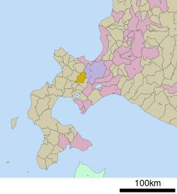
- Map of Kyogoku Abuta District Hokkaido Prefecture Japan
- Geography
- Neighboring municipalities
- History
- Public transport
- Highways
- Education
- Annual events
- Notable people from Kygoku
- References
Map of Kyogoku, Abuta District, Hokkaido Prefecture, Japan
The town borders the south ward (Minami-ku) of Sapporo, but car traffic from Kyōgoku must drive over an hour through the Nakayama Toge mountain pass to enter Sapporo.
Tourists visit the town to drink the spring water in Fukidashi Park, where the water from Mount Yōtei bubbles out of the ground.
The town has a sister city relationship with the city of Marugame in Kagawa Prefecture.
Geography
Kyōgoku is mountainous, with several peaks above 1,000 metres (3,300 ft). The town sits between Mount Yotei to the east, and Mount Muine (1,464 metres (4,803 ft)), Mount Nakadake 1,387.8 metres (4,553 ft), and Mount Kimobetsu (1,176.9 metres (3,861 ft)) to the west.
The Shiribetsu River (126 kilometres (78 mi)), which emerges from Lake Shikotsu to the south, runs through Kyōgoku between Mount Yotei and the western peaks in the town. The river eventually flows into the Sea of Japan.
Neighboring municipalities
History
Kyōgoku was first settled by the Japanese in 1897. Takanori Kyōgoku (1858-1928) was a former noble of the Kyōgoku clan and head of the Marugame Domain, Sanuki Province in present-day Kagawa Prefecture, Shikoku. Kyōgoku was given permission to set up an agricultural operation in the area, as part of Kutchan.
Public transport
Kyōgoku is not connected by rail to other areas of Hokkaido. The town was formally a stop on the Japanese National Railways (JR) Ibiri Line. The Ibiri Line ceased operation in 1986.
Highways
Japan National Route 227, a national highway of Japan, runs through the east of Kyōgoku and connects the town to Hakodate and Esashi.
Education
Elementary schools:
Junior high school: