Local time Sunday 6:38 AM | Population 2,323 (2008) | |
 | ||
Time zone Japan Standard Time (UTC+9) City hall address 118 Makkari, Makkari, Abuta-gun, Hokkaido048-1631 Weather -2°C, Wind NW at 11 km/h, 88% Humidity Points of interest Makkari Hot Spring, Makkari Kasen Park, Yoteizan Natural Park | ||
Makkari (真狩村, Makkari-mura) is a village located in Abuta District, Shiribeshi Subprefecture, Hokkaido, Japan.
Contents
- Map of Makkari Abuta District Hokkaido Prefecture Japan
- Geography
- Neighboring municipalities
- History
- Education
- Sister city
- References
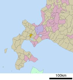
Map of Makkari, Abuta District, Hokkaido Prefecture, Japan
As of 2008, the village has an estimated population of 2,323. The total area is 114.43 km².
Geography
Makkari is located on the southern foot of Mount Yōtei. The name is derived from Ainu word "mak-kari-pet", meaning "River which flows around Mount Yōtei".
Neighboring municipalities
History
Education
Sister city
References
Makkari, Hokkaido Wikipedia(Text) CC BY-SA
