
Length 81 km (50 mi) | ||
 | ||
Similar Vienna Woods, Schloss Pöggstall, Karikaturmuseum Krems, Kunsthalle Krems, Gozzoburg | ||
The Krems is a river in Waldviertel in northern Lower Austria. There are in reality two rivers: the "Große Krems" (Greater Krems), meaning either the whole river system or the main river, while the smaller one is called the "Kleine Krems" (Lesser Krems). The Krems originally flowed into the Danube by Krems an der Donau, but when the Danube power station was built at Altenwörth, the mouth of the river – together with that of the Kamp – was moved to Altenwörth.
Map of Krems, Austria
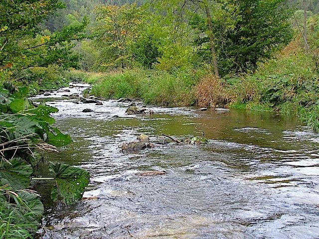
In the upper course both rivers flow through the rough granite landscape of the Waldviertel; important places are Großreinprechts by the Große Krems, and Kottes-Purk by the Kleine Krems. The Krems is the backbone of the wine region Kremstal, it passes Senftenberg and the ruins of Lengenfeld, and after it emerges from the granite and gneiss plateau (Böhmische Masse) it flows through the Tullnerfeld by Krems.
Beneath the Burg Hartenstein, at the confluence of the source rivers, is the cave Gudenushöhle by the bank, which was inhabited in the stone age.