
Headquarters Koderma Area 1,500 km² | Website Official website | |
 | ||
Administrative division North Chotanagpur division University Grizzly College of Education | ||
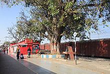
Koderma railway junction koderma
Koderma district is one of the twenty-four districts of Jharkhand state, India, and Koderma is the administrative headquarters of this district.
Contents
- Koderma railway junction koderma
- Map of Koderma Jharkhand
- Geography
- BlocksMandals
- Economy
- Education
- Transport
- Hospitals
- Diagnostic Centres
- Divisions
- Demographics
- References
Map of Koderma, Jharkhand
Koderma district was created on 10 April 1994, after being carved out of the original Hazaribagh district. It is currently a part of the Red Corridor.
Geography
Koderma is bordered by Nawada district of Bihar on the north, the Gaya district of Bihar on the west, the Giridih district of Jharkhand on the east, and the Hazaribag district of Jharkhand on the south.
Koderma is surrounded by forests and lots of natural resources, Dhawajadhari Pahar (hill) that is dedicated to lord SHIVA and on the MAHASHIVRATRI lots of devotees get together to worship the GOD.Barsoti river flows through the district.
Koderma district is richly endowed with natural resources. At one time, Koderma was considered as the mica capital of India. During that time, the townships of Koderma and Jhumeri Tilaiya saw the rise of several mica tycoons, including the houses of Bhadanis, Modi family including late chottu Modi and Rajgarhias. Now it the fastest developing city in Jharkhand.
Blocks/Mandals
Koderma district consists of 06 Blocks. The following are the list of the Blocks in Koderma district:
Economy
In 2006 the Indian government named Koderma one of the country's 250 most backward districts (out of a total of 640). It is one of the 21 districts in Jharkhand currently receiving funds from the Backward Regions Grant Fund Programme (BRGF).
Education
In the matter of education koderma known as backward city but in recent scenario lots of people from this district has got national level recognition because of education. lots of doctors, engineers and other professionals belong to this city. Lots of people from this region giving much stress on education. There are several schools and degree colleges in Koderma:
Transport
The district has three major towns - Koderma, Jhumri Telaiya, Domchanch. Koderma,Jhumri Telaiya are located along National Highway 31, which connects Ranchi and Patna. Koderma Railway station is on the Grand Chord railway line, which connects Calcutta and Delhi.
Hospitals
Diagnostic Centres
Divisions
The district comprises six blocks: Koderma, Jainagar, Markacho, Satgawan, Chandwara and Domchanch.
The Vidhan Sabha constituency of this district are Kodarma, Barkatha and Barhi, which are part of Koderma and Hazaribag Lok Sabha constituency respectively.
Demographics
According to the 2011 census Koderma district has a population of 717,169, roughly equal to the nation of Bhutan or the US state of Alaska. This gives it a ranking of 500th in India (out of a total of 640). The district has a population density of 427 inhabitants per square kilometre (1,110/sq mi) . Its population growth rate over the decade 2001-2011 was 32.59%. Kodarma has a sex ratio of 949 females for every 1000 males, and a literacy rate of 68.35%.