
Car plates PKL Population 88,244 (2010) | Area 1,011 km² | |
 | ||
Gminas Total 11 (incl. 1 urban)KołoGmina BabiakGmina ChodówGmina DąbieGmina GrzegorzewGmina KłodawaGmina KołoGmina KościelecGmina OlszówkaGmina Osiek MałyGmina Przedecz Points of interest Kłodawa Salt Mine, Zamek w Kole, Muzeum byłego niemiecki, Ratusz w Kole, Chelmno Extermination Camp | ||
Koło County (Polish: powiat kolski) is a unit of territorial administration and local government (powiat) in Greater Poland Voivodeship, west-central Poland. It came into being on January 1, 1999, as a result of the Polish local government reforms passed in 1998. Its administrative seat and largest town is Koło, which lies 119 kilometres (74 mi) east of the regional capital Poznań. The county contains three other towns: Kłodawa, 21 km (13 mi) east of Koło, Dąbie, 19 km (12 mi) south-east of Koło, and Przedecz, 21 km (13 mi) north-east of Koło.
Contents
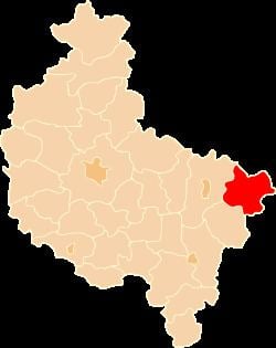
Map of Ko%C5%82o County, Poland
The county covers an area of 1,011.03 square kilometres (390.4 sq mi). As of 2010 its total population is 88,244, out of which the population of Koło is 23,034, that of Kłodawa is 6,829, that of Dąbie is 2,087, that of Przedecz is 1,771, and the rural population is 54,880.
History
Unit formed in Kalisz Governorate in 1867, since 1918 in the Second Polish Republic, German Landkreis Warthbrücken during World War II, later in Polish People's Republic, dissolved in 1975, reconstructed in 1998.
Neighbouring counties
Koło County is bordered by Radziejów County and Włocławek County to the north, Kutno County and Łęczyca County to the east, Poddębice County to the south-east, Turek County to the south, and Konin County to the west.
Administrative division
The county is subdivided into 11 gminas (one urban, three urban-rural and seven rural). These are listed in the following table, in descending order of population.