
Time zone CET (UTC+1) Population 62,559 (2014) | Area 1,163 km² Number of municipalities 20 | |
 | ||
Points of interest Destinations | ||
The Bezirk Kitzbühel is an administrative district (Bezirk) in Tyrol, Austria. It borders Bavaria (Germany) in the north, the Kufstein and Schwaz districts in the west, and the Pinzgau region (Salzburg) in the east and south.
Contents
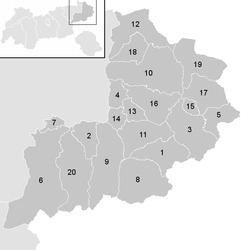
- Map of KitzbC3BChel District Austria
- Administrative divisions
- Towns
- Market towns
- Municipalities
- References
Map of Kitzb%C3%BChel District, Austria
Area of the district is 1,163.06 km², population was 61,966 (January 1, 2012), and population density 53 persons per km². Administrative center of the district is Kitzbühel.
Administrative divisions
The district is divided into 20 municipalities, one of them is a town, and three of them are market towns.
Towns
- Kitzbühel (8,134)
Market towns
- Fieberbrunn (4,396)
- Hopfgarten im Brixental (5,556)
- Sankt Johann in Tirol (8,734)
Municipalities
- Aurach bei Kitzbühel (1,125)
- Brixen im Thale (2,673)
- Going am Wilden Kaiser (1,866)
- Hochfilzen (1,139)
- Itter (1,176)
- Jochberg (1,583)
- Kirchberg in Tirol (5,102)
- Kirchdorf in Tirol (3,859)
- Kössen (4,202)
- Oberndorf in Tirol (2,019)
- Reith bei Kitzbühel (1,678)
- Sankt Jakob in Haus (759)
- Sankt Ulrich am Pillersee (1,609)
- Schwendt (790)
- Waidring (1,946)
- Westendorf (3,620)
(population numbers January 1, 2012)
References
Kitzbühel District Wikipedia(Text) CC BY-SA