
Area 2,128 km² | Vehicle registration TS–02 Literacy 69.2% | |
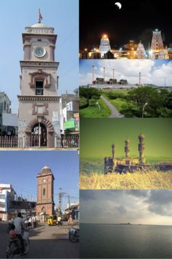 | ||
Website [karimnagar.nic.in Official website] Colleges and Universities Satavahana University Points of interest Sri Raja Rajeshwara temple, Ujwala Park, Elgandal Fort, Deer Park, Sri Raja Rajeshwara Swamy T Destinations Karimnagar, Ramagundam, Kaleshwaram, Sircilla, Koratla | ||
Karimnagar district is one of the 31 districts of the Indian state of Telangana. Karimnagar city is its administrative headquarters.
Contents
- Map of Karimnagar Telangana
- Etymology
- History
- Geography
- Demographics
- Administrative divisions
- Mandals
- Economy
- Notable people
- References
Map of Karimnagar, Telangana
Etymology
Karimnagar was originally called Elagandala. Later Kannada kingdoms such as Western Chalukyas ruled it. It was part of the great Satavahana Empire. Later,the ruling Nizams of Hyderabad changed the name to Karimnagar, derived from the name of Syed Karimullah Shah Saheb Quiladar.
History
Due to the districts re-organisation in October 2016, the district was carved out to form three new districts of Jagtial district, Peddapalli district and Siricilla district.
Geography
The district is spread over an area of 2,128 square kilometres (822 sq mi). Karimnagar shares it boundaries with Jagtial and Peddapalli district on north, Warangal Urban district and Siddipet district on south, Rajanna District on the East and Jayashankar Bhupalpally District on west.
Demographics
As of 2011 Census of India, the district has a population of 10,05,711.It has a literacy rate of 69.16% and density of 423 persons per sq.km., making it fifth most literate and densely populated district among 31 districts of Telangana. Total urban population of the district is 3,08,984, which is 30.72% of total population. It has a single municipal corporation (Karimnagar) and two Nagar-Panchayats(Huzurabad and Jammikunta).
Administrative divisions
The district is divided into two revenue divisions of Karimnagar and Huzurabad. These are sub-divided into sixteen mandals. There are 210 revenue villages and 276 Gram-Panchyats in the district. Sarfaraz Ahmed is the present collector of the district.
Mandals
The below table categorizes 16 mandals into their respective revenue divisions in the district:
Economy
Granite industry of the district include, Tan Brown and Maple Red variety of granite. In Karimnagar district, there are over 600 stone quarries spread over several mandals such as Karimnagar, Manakondur, Mallial, Kesavapatnam etc.
In 2006, the Indian government named undivided Karminagar district as one of the country's 250 most impoverished districts (out of 640). It is one of the nine earlier integrated districts in Telangana currently receiving funds from the Backward Regions Grant Fund Programme (BRGF).