Tehsil 15 | Tehsils 15 | |
 | ||
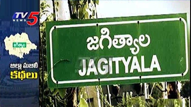
Jagtial district is a district located in the northern region of the Indian state of Telangana. It was a part of the Karimnagar district before re-organisation of districts in the state.
Contents
- Si brutally beats on younger boy jagtial district
- Geography
- Demographics
- Administrative divisions
- Mandals
- References
Si brutally beats on younger boy jagtial district
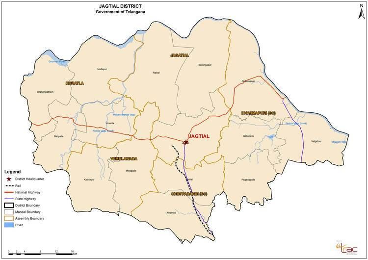
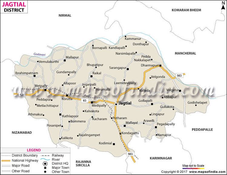
Geography
The district is spread over an area of 3,043.23 square kilometres (1,175.00 sq mi). Jagtial district shares it boundaries with Nirmal district and Mancherial district on North and North East respectively, it is bounded on South and South West by Karimnagar district and Peddapalli district respectively and on the West by Nizamabad district.
Demographics
As of 2011 Census of India, the district has a population of 983,414.
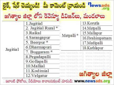
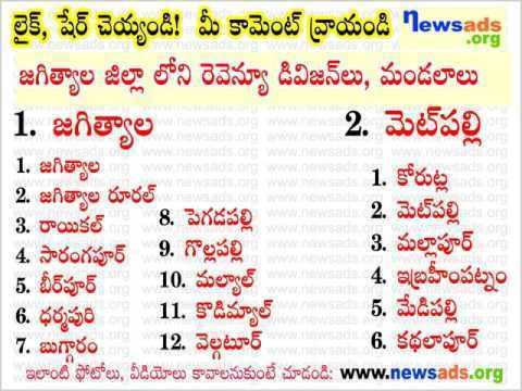
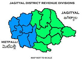
Administrative divisions
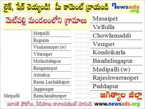
The district will have two revenue divisions of Jagtial and Metpally are sub-divided into 18 mandals.
Mandals
The below table categorizes mandals into their respective revenue divisions in the district: