
Address Lakeshore, CA 93634, USA Established January 1, 1964 | Governing body U.S. Forest Service Area 2,350 km² | |
 | ||
Management United States Forest Service Similar Kings Canyon National, Muir Trail Ranch, Wishon Village RV Park, Trapper Springs Campgro, Dinkey Lakes Wilderness | ||
John muir wilderness
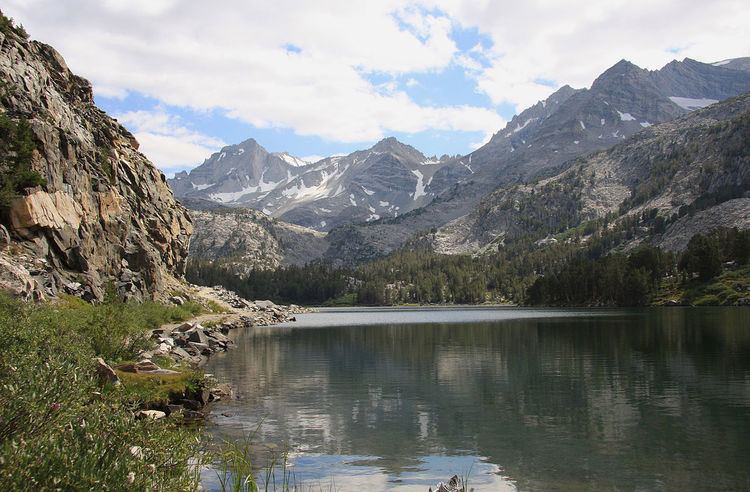
The John Muir Wilderness is a wilderness area that extends along the crest of the Sierra Nevada of California for 90 miles (140 km), in the Inyo and Sierra National Forests. Established in 1964 by the Wilderness Act and named for naturalist John Muir, it contains 581,000 acres (2,350 km2). The wilderness lies along the eastern escarpment of the Sierra from near Mammoth Lakes and Devils Postpile National Monument in the north, to Cottonwood Pass near Mount Whitney in the south. The wilderness area also spans the Sierra crest north of Kings Canyon National Park, and extends on the west side of the park down to the Monarch Wilderness.
Contents
John muir wilderness hike mcgee creek canyon
Geography and geology
The wilderness contains some of the most spectacular and highest peaks of the Sierra Nevada, with 57 peaks over 13,000 feet (4,000 m) in elevation. The peaks are typically made of granite from the Sierra Nevada Batholith, and are dramatically shaped by glacial action. The southernmost glacier in the United States, the Palisade Glacier, is contained within the wilderness area. Notable eastside glaciated canyons are drained by Rock, McGee, and Bishop Creeks.
The eastern escarpment in the wilderness rises from 6,000 to 8,000 feet (1,800 to 2,400 m) from base to peak, in 5 to 6 miles (8 to 10 km). The Sierra crest contains peaks from 12,000 to 14,000 feet (3,700 to 4,300 m) in elevation, including Mount Whitney, the highest peak in the continental United States. Other notable mountains in the wilderness area include the Palisades and Mount Humphreys. Mount Muir is located 2 miles south of Mount Whitney. Mount Williamson is the second-highest peak in the wilderness, at 14,375 feet (4,382 m): it rises in one continuous sweep of granite from the floor of the Owens Valley to a peak just east of the main range.
Ecology
The John Muir Wilderness contains the largest contiguous area above 10,000 feet (3,000 m) in the continental United States. It contains large areas of subalpine meadows and fellfields above 10,800 feet (3,300 m), containing stands of whitebark and foxtail pine. From 9,000 feet (2,700 m) to 10,800 feet (3,300 m), the wilderness is dominated by lodgepole pines. Below the lodgepole forest is forest dominated by Jeffrey pine.
Common animals in the wilderness include yellow-bellied marmots, pikas, golden-mantled ground squirrels, Clark's nutcrackers, golden trout, and black bears. The wilderness area also includes California bighorn sheep zoological areas, which are set aside for the protection of the species.
Recreation
The wilderness contains 589.5 miles (948.7 km) of hiking trails, including the John Muir Trail and the Pacific Crest Trail, which run through the wilderness from north to south. The John Muir Wilderness is the second most-visited wilderness in the United States, and quota are required for overnight use on virtually all trailheads.