Iron Range refers collectively or individually to a number of elongated iron-ore mining districts around Lake Superior in the United States and Canada. Despite the word "range," the iron ranges are not mountain chains, but outcrops of Precambrian sedimentary formations containing high percentages of iron. These cherty iron ore deposits are Precambrian in age for the Vermilion Range, while middle Precambrian in age for the Mesabi and Cuyuna Ranges. Similarly, the Gogebic Range in Wisconsin and the Marquette Iron Range and Menominee Range in Michigan. Natural ores and concentrates were produced from 1848 until the mid 1950s, when taconites and jaspers were concentrated and pelletized started to become the major source of iron production.
The far eastern area, containing the Duluth Complex along the shore of Lake Superior, and the far northern area, along the Canada–US border, of the region are not associated with iron ore mining. Due to its shape, the area is collectively referred to as the Arrowhead region of the state.
The area consists of seven counties: Aitkin, Carlton, Cook, Itasca, Koochiching, Lake, and Saint Louis.
The Iron Range and its economy
From a geological perspective, the Iron Range in Minnesota includes these four major iron deposits:
Mesabi Range, the largest iron range, largely within Itasca and Saint Louis counties;Vermilion Range, northeast of the Mesabi, in Saint Louis and Lake counties;Gunflint Range is in the extreme northern portion of Cook County and extends into Canada; andCuyuna Range, southwest of the Mesabi, largely within Crow Wing County.Within Minnesota, "The Iron Range Resources and Rehabilitation is a State Department, established by the legislature of 1941 to render public service through research and the actual development of all the state's resources both natural and human." The Iron Range Resources and Rehabilitation Board (IRRRB), known simply as "the I-triple-R-B" or Iron Range Resources, is an economic development agency funded partly by taxes levied by the state on taconite-producing companies and charged with creating jobs.
Geologically, the iron ranges in Minnesota belong to the Animikie Group. The geologic history of the formations containing iron are typical of banded iron formations worldwide.
Prior to the 19th century, Native American groups mined native copper on the Keweenaw Peninsula. William Austin Burt discovered iron ore in the Marquette Range near Negaunee, Michigan in 1844. Iron ore was quickly discovered on the Menominee Range in 1867, on the Gogebic Range in 1884, on the Vermilion Range in 1885, the Mesabi Range in 1890, and the Cuyuna Range in 1903.
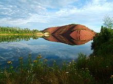
Underground mines developed to remove the valuable ore of most ranges. However, iron mining operations on the Mesabi and Cuyuna Ranges took place in enormous open pit mines where steam shovels and other industrial machines could remove massive amounts of ore. "Large-scale commercial production of magnetite taconite ore on the Mesabi Range started in 1956 at the Peter Mitchell Mine near Babbitt, Minnesota."
The Iron Range contains several smaller cities. Some of the more significant communities in the region include:
Aitkin (pop. 2,165) is located on the eastern edge of the Cuyuna Range. Aitkin was the birthplace of stage and film actor Warren William.Aurora (pop. 1,853) is located on the Eastern Mesabi Range. The former St. James, Meadow, Miller and Stephens mines lie within the city limits.Babbitt (pop. 1,475)Biwabik (pop. 969)Bovey (pop. 804) is located along U.S. Highway 169 between Coleraine and Taconite. Bovey was the birthplace of NHL goaltender Adam Hauser, San Francisco politician Richard Hongisto, and Eric Enstrom – photographer of the famous 1918 photograph "Grace."Buhl (pop. 1,000) is located along U.S. Highway 169 between Chisholm and Virginia. Buhl is known for its fine water and claims "The Finest Water in America" on its water tower.Chisholm (pop. 4,976) is the geographic center of the Mesabi Range, home of the Chisholm Bluestreaks. It is the home of Minnesota Discovery Center, the Minnesota Museum of Mining, and the Iron Range Research Center. Archibald "Moonlight" Graham, subject of the motion picture "Field of Dreams" settled in Chisholm. The motion picture "North Country" was also partly filmed in Chisholm.Coleraine (pop. 1,970) is referred to as the "start place of the Iron Range." The town was built in the early 20th century to accommodate the miners of the Oliver Iron Mining's Canisteo Mine. John Greenway was the superintendent of the mine; Greenway School District in Coleraine is named for him.Crosby (pop. 2,386) is an old mining boomtown on the southwestern edge of the Iron Range, home of the Crosby-Ironton Rangers.Duluth (pop. 86,265) The fourth largest city in the state, while not part of the Iron Range, is a destination for much of its production shipped via the DM&IR railroad. Iron pellets are shipped "downward" through the Soo Locks to steel towns such as Cleveland, Erie, Toledo et al. The Port of Duluth allows for the iron ore to be easily shipped through the Great Lakes.Deerwood (pop. 529) Mining engineer Cuyler Adams discovered the Cuyuna Range near Deerwood in 1895.Ely (pop. 3,460), in the Vermillion Range, is perhaps best known as the most popular entry point for the Boundary Waters Canoe Area Wilderness.Eveleth (pop. 3,718) is where U.S. Senator Paul Wellstone and seven others died in a plane crash in 2002 two miles away from the municipal airport. It also the site of the conflict that resulted in the Supreme Court case Jenson v. Eveleth Taconite Co. and the film North Country. It is also home of the United States Hockey Hall of Fame.Grand Rapids (pop. 10,869) is named for the local rapids in the Mississippi River, which was the uppermost limit of practical steamboat travel during the late 19th century. Today, those rapids are hidden underneath the dam of the Blandin Paper Mill, which has its papermaking facilities in downtown Grand Rapids. The city is considered to lie on the westernmost edge of the Mesabi Range. The current economy has a large tourist footing, with many local resorts, golf courses, and regional hunting and fishing. Grand Rapids is the birthplace of entertainer Judy Garland.Gilbert (pop. 1,799) is home of one of Minnesota's most well known off-highway vehicle parks. It is also the location of Lake Ore-be-gone, which is actually an artificial lake created by flooding three open-pit iron ore mines.Hibbing (pop. 16,361) is the largest city by area in the state of Minnesota and is the former boyhood home of Bob Dylan, basketball great Kevin McHale and the location of the Hull-Rust-Mahoning Open Pit Iron Mine, is one of the largest open pit iron mines in the world. Hibbing is also the birthplace of Roger Maris.Kinney (pop. 169) is an old mining boomtown on the Iron Range, located between Buhl and Mountain Iron.Mountain Iron (pop. 2,869) is home to Minntac, the world's largest taconite processing plant.Nashwauk (pop. 983) is a small town between Grand Rapids and Hibbing, 4 miles from Keewatin. There are a few pit lakes in the area that now hold bass, lake trout, and northern pike. Currently (2010), Essar Minnesota Steel LLC is constructing a new direct-reduction steel producing facility north of town. It is a first for the Iron Range, as it will have blast furnaces on-site to produce steel from the mining of taconite.Soudan is an unincorporated community in Breitung Township, Saint Louis County. It is located immediately east of the city of Tower on Minn.Highway 169 / Minn.Highway 1, where the area school and business district are located. It is the home of the Soudan Underground Mine State Park which contains the University of Minnesota's Soudan Underground Laboratory which houses detectors, including MINOS, over 700 meters below the surface of the Earth.Taconite (pop. 360) named after the taconite pellets from iron ore was a town many miners lived in. The town recently celebrated its centennial year and is famous for its rich hockey tradition.Two Harbors (pop. 3,745) is the county seat of Lake County, Minnesota along the shore of Lake Superior. The town was historically an important port for loading and shipping iron ore from the Range. However, like Duluth, Two Harbors is not itself a mining town.Virginia (pop. 8,712), perched next to the Rouchleau mine pit which is nearly three miles long, a half-mile wide and 450 feet deep. Virginia is the major retail shopping center of the northern part of the Iron Range, and has the Thunderbird Mall. Four miles north of Virginia is the Laurentian Divide, which separates the watershed of the streams that flow north to the Arctic Ocean from the watershed of the streams that flow southeast through the Great Lakes to the Atlantic Ocean. The motion picture "North Country" was also partly filmed in Virginia, notably the courthouse sequences.Winton (pop 172). Once several times larger than Ely, Winton sits just 3 miles north of Ely, and was once home to a very large lumber mill and was a lumber boomtown.The area has a recognizably Italian, Slavic, and Scandinavian/Nordic heritage. A strong Midwestern Minnesota accent is present in the area, especially among the older part of the populace, hence the popular nickname, "Da Range". See also North Central American English. Ice hockey is a predominant sport in the region, which has produced several NHL players as well as all three members of the "Iron line" from the 1980 U.S.A. Hockey Miracle on Ice team.
Bob Dylan memorialized the Iron Range in the 1963 song North Country Blues, a lament portraying hard times in the region. Presented in his 1964 album The Times They Are a-Changin', it includes such lines as:
So the mining gates locked and the red iron rottedAnd the room smelled heavy from drinkingWhen the sad, silent song made the hour twice as longAs I waited for the sun to go sinking The rural area has remained a Democratic-Farmer-Labor Party stronghold because of its history of a largely unionized workforce in the mining industry, the mainstay of the economy of the Iron Range. In 2004, John Kerry carried most of the counties in the region by a comfortable margin. This was perhaps aided by George W. Bush referring to the area as the "Iron Ridge" in a campaign speech. Barack Obama outperformed Kerry in 2008, carrying every county in the Iron Range. The area remains the greatest Democratic stronghold in Minnesota along with the urban centers of Minneapolis and St. Paul. In 2016, Donald Trump's populist message enabled him to gain ground in the Iron Range, winning multiple counties and reducing the Democratic margins of victory in others.
The region is known for unrelentingly harsh winters, and pleasant, albeit mosquito-infested summers. The average year-round temperature is in the 30s °F (between about 2 °C and 4 °C). Temperatures below -40 °F/°C occur somewhere in the region during most winters. For example, statistics from the Midwestern Regional Climate Center climate summaries [2], record that Virginia, MN has a mean annual temperature of 38 °F, with an average January low temperature of -6.2 °F (about -21 °C) and July high of 77.4 °F (25 °C). Precipitation there averages 27 in (690 mm) annually and snowfall 53.2 in (135 cm). Near Lake Superior, the temperature differences are somewhat less extreme, but due to its proximity to the lake annual snowfalls over 100 inches are common.