
Country United States Incorporated (village) June 9, 1891 Population 10,989 (2013) | Founded Circa 1872 Elevation 1,286 ft (392 m) Local time Saturday 3:43 AM | |
 | ||
Weather -4°C, Wind NW at 29 km/h, 89% Humidity Points of interest Judy Garland Museum, Children's Discovery Museum, Old Central School, American Legion Memorial | ||
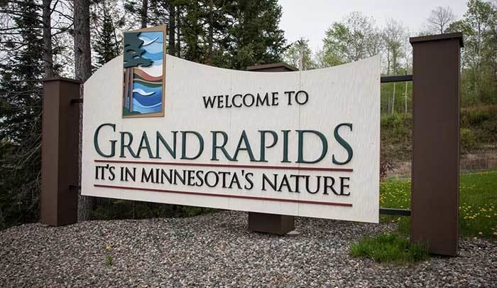
Grand Rapids is a city in Itasca County, Minnesota, United States. The population was 10,869 at the 2010 census. It is the county seat of Itasca County.
Contents
- Map of Grand Rapids MN 55744 USA
- History
- Geography
- Major highways
- Climate
- 2010 census
- 2000 census
- Religion
- Government
- Economy
- Annual tourism events
- Education
- Local radio stations
- Newspapers
- Television stations
- Notable people
- References
Map of Grand Rapids, MN 55744, USA
The city of Grand Rapids is named for the 3.5-mile (5.6 km) long local rapids in the Mississippi River, which was the uppermost limit of practical steamboat travel during the late 19th century. Today, those rapids are hidden underneath the dam of the Blandin Paper Mill.
History
Grand Rapids was founded as a logging town, as the Mississippi River provided an optimal method of log shipment to population centers. The predecessor of the Blandin paper mill opened in 1902.
The town was also the childhood home of Judy Garland, born Frances Ethel Gumm.
The Forest History Center is a State Historic Site and a living history museum that recreates life as it was in a turn of the 20th century logging camp. Costumed interpreters guide visitors through a recreated circa 1890s logging camp to educate the public on the history of white pine logging and its relevance to today's economy. Miles of nature trails, educational naturalist programming, and an interpretive museum are also located on the site.
Old Central School, located in downtown Grand Rapids, was built in 1895 in the Richardsonian Romanesque style of architecture. The three story building served as an elementary school from 1895 to 1972. A community effort restored the building in 1984 and it now serves as a location for commerce and is listed on the National Register of Historic Places.
Geography
According to the United States Census Bureau, the city has a total area of 24.44 square miles (63.30 km2), of which 22.56 square miles (58.43 km2) is land and 1.88 square miles (4.87 km2) is water.
Grand Rapids is the county seat of Itasca County, a county that contains over 1000 lakes.
The city of Grand Rapids sits at the junction of U.S. Highways 2 and 169. U.S. Highway 2 runs west towards Bemidji and east towards Duluth. U.S. Highway 169 heads south to Hill City, and ultimately towards the city of Minneapolis. In the other direction, U.S. Highway 169 heads up the Mesabi Range until it reaches the city of Virginia, passing through Hibbing and several other smaller towns along the way. Grand Rapids is also the starting point of State Highway 38, running 47 miles (76 km) north along the Edge of the Wilderness Scenic Byway towards Effie. State Highway 38 has been designated a National Scenic Byway by the United States Department of Transportation.
Major highways
The following routes are located within the city of Grand Rapids.
Climate
The city of Grand Rapids has a Humid continental climate (Köppen Climate Classification Dfb) with warm summers and long, cold winters, typical of its location on the Mesabi Iron Range.
2010 census
As of the census of 2010, there were 10,869 people, 4,615 households, and 2,633 families residing in the city. The population density was 481.8 inhabitants per square mile (186.0/km2). There were 4,910 housing units at an average density of 217.6 per square mile (84.0/km2). The racial makeup of the city was 94.6% White, 0.6% African American, 1.9% Native American, 0.6% Asian, 0.3% from other races, and 2.0% from two or more races. Hispanic or Latino of any race were 1.2% of the population.
There were 4,615 households of which 26.6% had children under the age of 18 living with them, 41.1% were married couples living together, 12.4% had a female householder with no husband present, 3.6% had a male householder with no wife present, and 42.9% were non-families. 36.5% of all households were made up of individuals and 17.1% had someone living alone who was 65 years of age or older. The average household size was 2.20 and the average family size was 2.84.
The median age in the city was 42 years. 22.2% of residents were under the age of 18; 8.5% were between the ages of 18 and 24; 22.4% were from 25 to 44; 26% were from 45 to 64; and 20.8% were 65 years of age or older. The gender makeup of the city was 47.5% male and 52.5% female.
2000 census
As of the census of 2000, there were 7,764 people, 3,446 households, and 1,943 families residing in the city. The population density was 1,057.8 people per square mile (408.4/km²). There were 3,621 housing units at an average density of 493.3 per square mile (190.5/km²). The racial makeup of the city was 95.53% White, 0.28% African American, 1.93% Native American, 0.71% Asian, 0.03% Pacific Islander, 0.39% from other races, and 1.13% from two or more races. Hispanic or Latino of any race were 0.85% of the population.
There were 3,446 households out of which 25.6% had children under the age of 18 living with them, 41.5% were married couples living together, 11.8% had a female householder with no husband present, and 43.6% were non-families. 38.1% of all households were made up of individuals and 20.4% had someone living alone who was 65 years of age or older. The average household size was 2.15 and the average family size was 2.82.
In the city, the population was spread out with 22.1% under the age of 18, 10.0% from 18 to 24, 23.9% from 25 to 44, 21.0% from 45 to 64, and 23.0% who were 65 years of age or older. The median age was 41 years. For every 100 females there were 87.0 males. For every 100 females age 18 and over, there were 81.7 males.
The median income for a household in the city was $28,991, and the median income for a family was $39,468. Males had a median income of $36,035 versus $20,759 for females. The per capita income for the city was $17,223. About 9.2% of families and 11.2% of the population were below the poverty line, including 15.1% of those under age 18 and 6.4% of those age 65 or over.
Religion
St. Luke's Evangelical Lutheran Church is a Christian church of the Wisconsin Evangelical Lutheran Synod (WELS) in Grand Rapids.
St. Andrew's Lutheran Church is a Christian church in Grand Rapids. It is a member congregation of the Evangelical Lutheran Church in America (ELCA).
Zion Lutheran Church is a Christian church in Grand Rapids. It is also a member congregation of the ELCA.
St. Joseph's Roman Catholic Church is also in Grand Rapids.
Government
Grand Rapids is represented at the federal and state level by:
Economy
Historically, the local economy was based on timber harvesting, and to this day, Blandin Paper Mill, now owned by the Finnish-based UPM paper company, has its papermaking facilities in downtown Grand Rapids, while Ainsworth (formerly Potlach) located just outside the city limits, produced oriented strand board until it ceased operation in September 2006.
The Mesabi Range or Iron Range region of Minnesota begins with one iron mine to the southwest and a number to the northeast of the city. Although technically and geographically a member of the Iron Range, Grand Rapids and its economy has been historically based on paper manufacturing and other wood products. Its current economy also has a large tourist footing, with many local resorts, four golf courses, over one million acres (4,000 km²) of public and industrial forestlands that provide excellent regional hunting, and more than 1,000 lakes for fishing. It also is the service center for 46,000 people due to a large seasonal and weekend population of summer residences on surrounding lakes, and a number of smaller bedroom communities located near Grand Rapids.
Grand Rapids was the first rural city in Minnesota to be served by an Advanced Life Support Ambulance Service.
Annual tourism events
Education
Grand Rapids has one of the few competitive high school marching bands north of the Twin Cities. Schools in ISD 318 include:
Grand Rapids also has the following parochial and secondary schools:
Local radio stations
The following radio stations based in Grand Rapids. The city is also served by many other radio stations from around the Iron Range area.
Newspapers
Television stations
Grand Rapids TV is primarily fed in from Duluth, MN television stations, but some cable subscribers also receive Bemidji, MN & Minneapolis, MN television stations as well. Local government and community events are covered by the local community television station. Television stations available in Grand Rapids are:
Notable people
Grand Rapids was the birthplace and early childhood home of legendary singer and actress Judy Garland, although her family moved to Lancaster, California, when she was four years old. The Itasca County Historical Society maintains a Judy Garland exhibit in their Heritage Museum and Judy's fully restored birthplace, in a home built in 1892, is open to the public as the Judy Garland Museum.
Notable people who were born in Grand Rapids or lived in the city include: