
County Johnston Elevation 53 m Population 6,237 (2013) | Chartered February 11, 1873 Time zone Eastern (EST) (UTC-5) Zip code 27576 Local time Sunday 9:31 PM | |
 | ||
Weather 18°C, Wind S at 10 km/h, 65% Humidity | ||
Selma is a town in Johnston County, North Carolina, United States. In 2010, the population was 6,073. Selma is part of the Raleigh-Durham-Cary Combined Statistical Area, and the Raleigh-Cary Metropolitan Statistical Area. The area has a population over 1.7 million residents, though the town of Selma is able to maintain its rural character. The Everitt P. Stevens House, located in Selma, was the site of the last Grand Review of the Confederate Army held on April 6, 1865, after its defeat at the Battle of Bentonville.
Contents
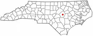
- Map of Selma NC USA
- Geography
- Demographics
- Religion
- Law and government
- Air
- Designated routes and highways
- Passenger rail service
- Commercial rail service
- Public transit
- History
- Education
- Museums
- Performing arts
- Television
- Newspapers
- Radio stations
- Notable people
- References
Map of Selma, NC, USA
Geography
Selma is located at 35°32′13″N 78°17′5″W (35.536982, -78.284642).
According to the United States Census Bureau, the town has a total area of 3.2 square miles (8.3 km2), all of it land.
Demographics
As of the census of 2000, there were 5,914 people, 2,254 households, and 1,480 families residing in the town. The population density was 1,830.6 people per square mile (706.9/km²). There were 2,515 housing units at an average density of 778.5 per square mile (300.6/km²). The racial makeup of the town was 47.09% White, 40.33% Black, 0.57% Indian, 0.19% Asian, 0.08% Pacific Islander, 9.89% from other races, and 1.84% from two or more races. Hispanics or Latinos of any race were 19.02% of the population.
There were 2,254 households out of which 31.9% had children under the age of 18 living with them, 38.1% were married couples living together, 21.3% had a female householder with no husband present, and 34.3% were non-families. 28.7% of all households were made up of individuals and 11.8% had someone living alone who was 65 years of age or older. The average household size was 2.61 and the average family size was 3.17.
In the town, the population was spread out with 27.9% under the age of 18, 11.6% from 18 to 24, 28.6% from 25 to 44, 20.4% from 45 to 64, and 11.5% who were 65 years of age or older. The median age was 31 years. For every 100 females there were 94.2 males. For every 100 females age 18 and over, there were 88.8 males.
The median income for a household in the town was $23,856 and the median income for a family was $32,430. Males had a median income of $26,886 versus $21,453 for females. The per capita income for the town was $12,101. About 23.1% of families and 30.0% of the population were below the poverty line, including 45.9% of those under age 18 and 22.1% of those age 65 or over.
Religion
Selma is home to a variety of religious practitioners. Approximately 36% of people in Selma are affiliated with a religion. The predominant religion in Selma is Christianity, with the largest numbers of adherents being Baptist (15.64%) and Methodist (6.02%). Others include Pentecostal (4.02%), Roman Catholic (2.52%) and Presbyterian (1.46%).
Law and government
Selma operates under a council-manager government. The town council consists of the mayor and four council members. All four council members are elected at-large.
Air
Johnston County Airport (IATA: JNX, ICAO: KJNX, FAA LID: JNX) is a general aviation airport located approximately 7 miles west of Selma in Smithfield.
Raleigh-Durham International Airport (IATA: RDU, ICAO: KRDU, FAA LID: RDU) is the region's primary airport, located approximately 40 miles northwest of Selma, between Raleigh and Durham.
Designated routes and highways
Passenger rail service
Amtrak's Palmetto and Carolinian passenger trains stop at the historic Selma Union Depot. They offer service to Charlotte, New York City, Savannah, and intermediate points.
Commercial rail service
Public transit
The Johnston County Area Transit System (JCATS) is a coordinated transit system that provides transportation services in Selma and throughout Johnston County.
History
On May 1, 1867, lots were sold around a newly established station on the North Carolina Railroad. From those lots, the town was built and considered a railroad town for many decades. Selma was officially chartered as a town on February 11, 1873. The town recently renovated its 1924 passenger depot, which has Amtrak service. The town is also home to the Mitchener Station, which was built in 1855 and thought to be the oldest surviving train station in North Carolina. After Interstate 95 was built in the late 1950s, the town experienced growth due to its location next to the interstate. Today, there are many hotels and restaurants located in the area thanks to the traffic from I-95.
The Downtown Selma Historic District, Noah Edward Edgerton House, Richard B. Harrison School, Nowell-Mayerburg-Oliver House, William E. Smith House, Everitt P. Stevens House, Selma Union Depot, and West Selma Historic District are listed on the National Register of Historic Places.
Education
Selma is home to two schools within the Johnston County School District:
Museums
Performing arts
Television
Selma is part of the Raleigh-Durham-Fayettville Designated Market Area. The following stations have broadcast facilities in the city:
Newspapers
There are several newspapers and periodicals serving the city:
Radio stations
Selma is part of the Raleigh-Durham Arbitron radio market. The following stations transmit from the city: