
Existed: 1956 – present Length 231.1 km | Constructed 1956 | |
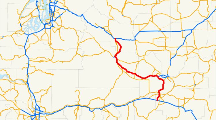 | ||
West end: I‑90 / US 97 in Ellensburg, WA | ||
Interstate 82
Interstate 82 (I-82) is a 143.58-mile (231.07 km) Interstate Highway in the northwest United States, extending from I-90 in Ellensburg, Washington, to I-84 near Umatilla, Oregon.
Contents
Map of I-82, United States
In Washington, it serves the cities of Ellensburg, Yakima, and the Tri-Cities (via I-182), and in Oregon, it serves Umatilla and Hermiston. Constructed from 1969 to 1987, it is the major route westwards to Seattle and eastwards to Boise and Salt Lake City (via I-84 and I-15). I-82's designation is a violation of the Interstate system's numbering rules, as it is located north of I-84, and is also primarily a north-south route. I-84 was originally designated I-80N, but received its current number in 1980 as part of efforts to eliminate suffixed routes.
I-82 passes over Selah Creek on the Fred G. Redmon Bridge. At its opening 46 years ago on November 2, 1971, it was the longest concrete arch bridge in North America. The bridge spans 549 feet (167 m) across the creek.
In 1999, a plan surfaced to extend the Interstate down south through Oregon. Three routes were proposed but all were rejected.
Route description
I-82 starts at an interchange with I-90 and U.S. Route 97 (US 97) in Ellensburg. At this point, I-82/US 97 start heading southeast towards Yakima, on roadbed graded and constructed from 1969 to 1971. (US 97 was previously routed through the serpentine Yakima River canyon, today's State Route 821 (SR 821).) Before entering Yakima, I-82/US 97 intersects SR 821 and State Route 823 (SR 823) while passing the Yakima Firing Center.
Just north of Selah, the freeway passes over Selah Creek on the Fred G. Redmon Bridge, the longest concrete arch in North America at the time of its opening, spanning 549 feet (167 m) across the creek. From the bridge, I-82/US 97 passes from Selah into Yakima. In Yakima, I-82/US 97 join US 12 and intersect SR 24. After leaving Yakima and Union Gap, US 97 splits from I-82/US 12. I-82 then enters the Yakama Indian Reservation as it starts turning eastward towards the Tri-Cities. West of Toppenish, I-82/US 12 intersects SR 22, and then goes east past Zillah and into Granger, where it intersects SR 223.
After leaving both Granger and the Yakama Indian Reservation, the freeway continues east to Sunnyside, where the highway intersects SR 241. Then, I-82/US 12 turns southeast to pass Grandview and reach Prosser, where SR 22 intersects the freeway. From Prosser, the highway turns northeast into Benton City, where SR 224 and SR 225 intersect I-82/US 12. From Benton City, the freeway goes eastward towards Richland, when I-182 starts and US 12 joins I-182 into Richland. From the interchange, I-82 goes southeast around the Tri-Cities and joins US 395. After joining US 395, the freeway goes south and then west into Plymouth, where the highway intersects SR 14 and leaves Washington on the Umatilla Bridge over the Columbia River heading into Oregon. The original bridge of 1955 carries eastbound traffic (south over the river) and the newer 1988 bridge goes westbound (north over the river).
After crossing the bridge into Oregon, I-82/US 395 enter Umatilla, where US 395 exits off at the intersection with US 730. After leaving Umatilla, the highway goes southwest and passes the Umatilla Ordnance Depot before ending at I-84/US 30 southwest of Hermiston.
History
As part of Washington's first connected state highway system, the Washington State Legislature designated the Inland Empire Highway between Ellensburg and Laurier in 1913. The State Highway Board selected a route that would connect the main cities of Eastern Washington and the Inland Empire, which were Ellensburg, Yakima, the Tri Cities, Colfax, and Spokane. In 1923, by which time the entire road had been improved, the highway became State Road 3 (Primary State Highway 3 and Primary State Highway 3 WA after 1937), but retained its name. By that time, most of the route of Interstate 82 became parts of US 410, US 97, and US 395, all three were established in 1926.
In 1956, President Dwight D. Eisenhower signed the Federal Aid Highway Act of 1956, which started the construction of Interstate Highways. Even though I-82 was designated in 1956, construction did not start until March 1969, and the last section of within Washington opened in 1987. Legally, the Washington section of I-82 is defined at Washington Revised Code § 47.17.135. Several projects are currently ongoing and have been completed in the recent years on I-82.
I-82 was meant to go from Tacoma, across Naches Pass, and then southeast into Yakima and the Tri-Cities. The proposal was quickly denied and later resurfaced as the SR 168 Proposal.
The original plans for the included two options. One was the current route (which was opposed by the Tri-Cities), and another had I-82 go from Prosser into Richland and Pasco, and then southeast to Wallula and then end at I-80N (present-day I-84) in Pendleton. The first option was chosen, but the Tri-Cities needed access, so the Federal Highway Administration created Interstate 182, which would serve as a connector from I-82 to the Tri-Cities.
When I-80N was renumbered I-84 in 1980, I-82's designation became a violation of the Interstate system's numbering rules, as it was now located north of I-84. The reason for the renumbering was a change in guidelines published by the American Association of State Highway and Transportation Officials that advised renumbering suffixed routes. In 1999, a plan surfaced to extend I-82 further south in Oregon. Three major routes were proposed including the Madras Route, from Umatilla through Heppner, Condon, Fossil, and Antelope to Madras, where I-82 would replace US 97 south through Bend to the California border, the Prineville route, from Umatilla through Heppner, Hardman, Spray, Prineville, and Powell Butte to US 97 near Bend, then continue south to the border, and the US 395 route, from Umatilla through John Day, Burns, and Lakeview, presumably to the California border and beyond.