
Length 467.4 km | ||
 | ||
Existed: 1955 (proposed in 1939) – present | ||
Interstate 55 (I-55) is a major north–south Interstate Highway that serves the middle of the United States. It runs 963.5 miles (1,550.6 km) from Interstate 10 in Laplace, Louisiana - about 25 miles (40 km) west of New Orleans to U.S. 41 in Chicago, Illinois.
Contents
Route description
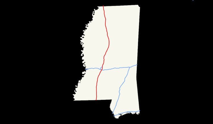
In Mississippi, I-55 runs 290.5 miles (467.5 km) from the Louisiana border near Osyka to Southaven on the Tennessee border, just south of Memphis. The highway parallels U.S. 51 during its trek roughly through the center of Magnolia State. North of Jackson, the Interstate runs east of the bluffs of the Mississippi Delta.
Number of lanes
Overlap with Interstate 69
On January 18, 2008, the Federal Highway Administration authorized the states of Mississippi and Tennessee to extend I-69 from the I-40/TN 300 interchange in north Memphis to the I-55/I-69 interchange in Hernando; in late May 2008, Mississippi began posting signs reflecting the extension of the route.