
Website www.madison-co.com Area 1,922 km² Population 100,412 (2013) | Founded 1828 Unemployment rate 3.8% (Apr 2015) | |
 | ||
Points of interest Mississippi Petrified Forest, Freedom Ridge, Old Trace Park, Strawberry Patch Park, Cypress Swamp | ||
Madison County is a county located in the U.S. state of Mississippi. As of the 2010 census, the population was 95,203. The county seat is Canton. The county is named for U.S. President James Madison.
Contents
- Map of Madison County MS USA
- Geography
- Adjacent counties
- National protected area
- Demographics
- Cities
- Towns
- Census designated place
- Other uincorporated communities
- Ghost town
- References
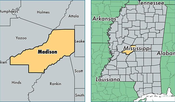
Map of Madison County, MS, USA
Madison County is part of the Jackson, MS Metropolitan Statistical Area.
Geography
According to the U.S. Census Bureau, the county has a total area of 742 square miles (1,920 km2), of which 715 square miles (1,850 km2) is land and 27 square miles (70 km2) (3.7%) is water. The southeastern border of the county is defined by the old course of the Pearl River before it was dammed to create the 33,000 acres (130 km2) Ross Barnett Reservoir.
The boundaries of the county are set in Mississippi Code section 19-1-89 as: Madison County is bounded by beginning at a point on Big Black River, where the same crosses the center line in township twelve, range three, east; thence east to the old Choctaw boundary line; thence north on said boundary line to the center line of township twelve, range five, east; thence through the center of said township twelve, range five, east, to the range line between townships five and six, east; thence south on said range line to Pearl River; thence down said river, with its meanderings, to the line between townships six and seven, north; thence west on said township line to the basis meridian of the Choctaw survey; thence north on said meridian line to the line between townships seven and eight, north; thence west on said township line to the line between ranges two and three, west; thence north on said range line to Big Black River; thence up said river, with its meanderings, to the beginning.
Adjacent counties
National protected area
Demographics
As of the census of 2000, there were 74,674 people, 27,219 households, and 19,325 families residing in the county. The population density was 104 people per square mile (40/km²). There were 28,781 housing units at an average density of 40 per square mile (16/km²). The racial makeup of the county was 60.29% White, 37.48% Black or African American, 0.11% Native American, 1.30% Asian, 0.02% Pacific Islander, 0.27% from other races, and 0.53% from two or more races. 0.99% of the population were Hispanic or Latino of any race.
There were 27,219 households out of which 37.40% had children under the age of 18 living with them, 51.90% were married couples living together, 15.60% had a female householder with no husband present, and 29.00% were non-families. 25.00% of all households were made up of individuals and 6.70% had someone living alone who was 65 years of age or older. The average household size was 2.67 and the average family size was 3.23.
In the county, the population was spread out with 28.60% under the age of 18, 8.90% from 18 to 24, 32.40% from 25 to 44, 20.30% from 45 to 64, and 9.70% who were 65 years of age or older. The median age was 33 years. For every 100 females there were 90.20 males. For every 100 females age 18 and over, there were 86.20 males.
The median income for a household in the county was $46,970, and the median income for a family was $58,172. Males had a median income of $41,460 versus $29,170 for females. The per capita income for the county was $23,469. About 10.60% of families and 14.00% of the population were below the poverty line, including 21.30% of those under age 18 and 13.20% of those age 65 or over.
Madison County has the highest per capita income in the State of Mississippi. It is the only county in Mississippi with a per capita income higher than the nation average.