
Existed: 1957 – present Constructed 1957 | Length 532.7 km | |
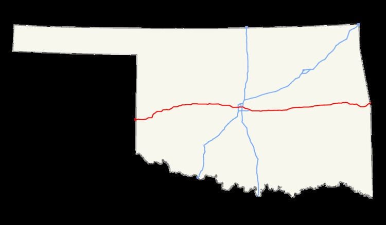 | ||
Interstate 40 (I-40) is an Interstate Highway in Oklahoma that runs 331 miles (533 km) across the state from Texas to Arkansas. West of Oklahoma City, it parallels and replaces Old US-66, and east of Oklahoma City, it parallels US-62, 266, and 64.
Contents
- Route description
- History
- Bridge collapse
- 2015 shootings
- Oklahoma City Crosstown realignment
- Business routes and old alignments
- Auxiliary route
- References
Cities along the route include Erick, Sayre, Elk City, Clinton, Weatherford, Oklahoma City and its suburbs (El Reno, Yukon, Del City, Midwest City, and Shawnee), Okemah, Henryetta, Checotah, and Sallisaw.
Route description
Interstate 40 enters Oklahoma near Texola, in Beckham County. It crosses the North Fork of the Red River near Sayre and runs through the south side of Elk City. It then cuts across the northwest corner of Washita County before entering Custer County, where it passes through Clinton and Weatherford. After leaving Weatherford, I-40 then runs across the northern tip of Caddo County before it enters the Oklahoma City Metro Area at Canadian County.
I-40 runs through the south side of El Reno as it enters the Oklahoma City metro. It then passes through Yukon before entering Oklahoma City city limits. In west Oklahoma City, I-40 has a junction with Interstate 44 (the Amarillo Junction). It then runs just south of downtown Oklahoma City on a new ten lane section. I-40 then interlines with Interstate 35 at the Dallas Junction complex, forming a concurrency with it for about two miles (3 km). After the Dallas Junction, I-40 then passes through Del City and Midwest City on a freeway known as the Tinker Diagonal, providing access to Tinker Air Force Base in east Oklahoma City.
In far eastern Oklahoma City, I-40 meets Interstate 240 in a partial junction before passing through the north side of Shawnee marking the eastern end of the OKC metro area. In Henryetta, I-40 serves as the northern terminus of the Indian Nation Turnpike. In McIntosh County, it crosses the northernmost arm of Lake Eufaula and meets the US-69 freeway south of Checotah.
Near Webbers Falls, I-40 is the southern terminus of the Muskogee Turnpike. It then crosses the Arkansas River before heading around southern Sallisaw. The interstate crosses into Arkansas north of Moffett.
History
West of Oklahoma City, Interstate 40 parallels and replaces Old US-66. US-66 was decommissioned in Oklahoma in 1985.
Bridge collapse
The I-40 bridge over the Arkansas River/McClellan-Kerr Navigation System near Webbers Falls was struck by a barge on May 26, 2002, causing the bridge to collapse and resulting in the death of 14 people.
Westbound I-40 traffic was detoured through Gore and Webbers Falls along SH-10, US-64, and SH-100, while eastbound traffic was diverted through Porum and Stigler along SH-2, SH-9, and US-59. Delays of thirty to fifty minutes on the 12-mile (19 km) westbound detour were typical, although trains passing through Gore could lengthen wait times by 15 minutes. The eastbound detour added 40 miles (64 km) and two hours to the typical trip. Some travelers chose to avoid the area entirely; one Tulsa trucking firm detoured trucks via Springdale, adding 70 miles (110 km) to the trip.
The detour significantly impacted the town of Gore. Local firefighters directed traffic there 24 hours a day, with daytime temperatures approaching 100 °F (38 °C). Businesses in Gore reported loss of revenue due to the traffic; one gas station reported a 30% decline in revenue while traffic was detoured through town.
2015 shootings
On December 17, 2015, a Pasadena, Texas man allegedly shot and killed two people on Interstate 40 near Weatherford, Oklahoma. He was arrested by police in Clinton, Oklahoma.
Oklahoma City Crosstown realignment
The original I-40 Oklahoma City Crosstown Expressway was built in 1966 mostly as an elevated route; however, this former stretch was too narrow for existing traffic, and was frequently in disrepair. In response, the I-40 Crosstown Expressway has been relocated a few blocks south of the original route, and the original bridge torn down. The project was completed in February 2012.
The new I-40 Crosstown Expressway has been designed to carry 170,000+ vehicles-per-day traveling at 60 miles-per-hour (97 km/h) using at-least ten lanes for traffic, and has breakdown lanes for disabled vehicles and future lane expansion.
When the new crosstown opened in 2012, nearly 95% of non-rush hour traffic was considered 'through traffic'; not transferring to or from downtown streets.
A landscaped boulevard is currently under-construction (circa 2016) replacing the original I-40 Crosstown Bridge right-of-way through downtown Oklahoma City; similar to the I-30 reconstruction through downtown Fort Worth, Texas.
Business routes and old alignments
I-40 has eight business routes in Oklahoma, six of which are old alignments of US-66. A number of other old alignments of US-66 are also present west of Oklahoma City.
Erick I-40 Business Loop (formerly US-66) is a Business Loop that runs from I-40 two miles (3 km) west of Erick to the old alignment of US-66, through Erick, and back to I-40, four miles (6 km) east of Erick.
Sayre I-40 Business Loop (formerly US-66) is a Business Loop that begins two miles (3 km) south of Sayre at US-283, runs north into the city, and then leaves Sayre to the east, rejoining I-40 two miles (3 km) east of US-283.
Elk City I-40 Business Loop (formerly US-66) is a Business Loop that begins at Exit 32, seven miles (11 km) west of Elk City. It runs for ten miles (16 km) through Elk City, rejoining I-40 at Exit 41.
Clinton I-40 Business Loop (formerly US-66) is a Business Loop that begins at Exit 65, runs five miles (8 km) through Clinton, and rejoinds I-40 at Exit 69.
Weatherford I-40 Business Loop (formerly US-66) is a Business Loop that exits I-40 at Exit 82B, runs four miles (6 km) through Weatherford, and rejoins I-40 at Exit 82.
El Reno I-40 Business Loop (formerly US-66) is a Business Loop through El Reno. It exits I-40 at Exit 119, runs eight miles (13 km) through El Reno, and rejoins I-40 at Exit 125, the interchange with US-81.
Henryetta I-40 Business Loop (formerly US-62/US-75) is a Business Loop that leaves I-40 at Exit 237, runs four miles (6 km) through Henryetta, and rejoins I-40 at Exit 240, the interchange with US-75 and the Indian Nation Turnpike.
Sallisaw I-40 Business Loop is a Business Loop that leaves I-40 at Exit 308, US-59, runs four miles (6 km) through Sallisaw, and rejoins I-40 at Exit 311, US-64.
Auxiliary route
I-40 has one auxiliary route in Oklahoma: