
Founded 1890 Website www.oklahomacounty.org Population 755,245 (2013) Unemployment rate 3.4% (Apr 2015) | Area 1,860 km² | |
 | ||
Colleges and Universities University of Central Oklahoma, University of Oklahom, Oklahoma City Communi, Rose State College, Oklahoma City University Destinations | ||
Oklahoma County is a county located in the central part of the U.S. state of Oklahoma. As of the 2010 census, the population was 718,633, making it the most populous county in Oklahoma. The county seat is Oklahoma City, the state capital.
Contents
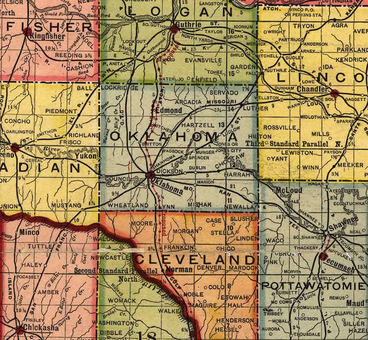
- Map of Oklahoma County OK USA
- History
- Geography
- Major highways
- Adjacent counties
- National protected area
- Demographics
- Cities
- Towns
- Unincorporated communities
- References
Map of Oklahoma County, OK, USA
Oklahoma County is at the heart of the Oklahoma City Metropolitan Statistical Area.
Oklahoma County is one of seven counties in the United States to share the same name as the state it is located in (the other six counties are Arkansas County, Hawaii County, Idaho County, Iowa County, New York County, and Utah County).
History
Oklahoma County was originally called County Two and was one of seven counties established by the Organic Act of 1890.
County business initially took place in a building at the intersection of California Avenue and Robinson Street until the construction of the first Oklahoma County Courthouse at 520 West Main Street in the 1900s. In 1937, the county government was moved to a building at 321 Park Avenue, which now serves only as the county courthouse.
Geography
According to the U.S. Census Bureau, the county has a total area of 718 square miles (1,860 km2), of which 709 square miles (1,840 km2) is land and 9.6 square miles (25 km2) (1.3%) is water.
Major highways
Adjacent counties
National protected area
Demographics
As of the Census of 2010, there were 718,633 people, 277,615 households, and 172,572 families residing in the county. The population density was 1,013 people per square mile (391/km²). There were 319,828 housing units at an average density of 416 per square mile (161/km²). The racial makeup of the county was 64.6% White, 15.4% Black or African American, 3.5% Native American, 3% Asian, 0.1% Pacific Islander, 8.1% from other races, and 5.3% from two or more races. 15.1% of the population were Hispanic or Latino of any race. 12.4% were of German, 12.3% Mexican, 10.1% Irish, 7.9% English, and 7.7% American ancestries according to the Census 2010. 84.4% spoke English and 11.5% Spanish as their first language.
There were 277,615 households out of which 28.5% had children under the age of 18 living with them, 43.1% were married couples living together, 15.4% had a female householder with no husband present, and 37.8% were non-families. 31.9% of all households were made up of individuals and 9.7% had someone living alone who was 65 years of age or older. The average household size was 2.56 and the average family size was 3.26.
In the county, the population was spread out with 25.60% under the age of 18, 10.90% from 18 to 24, 30.00% from 25 to 44, 21.40% from 45 to 64, and 12.20% who were 65 years of age or older. The median age was 34 years. For every 100 females there were 94.20 males. For every 100 females age 18 and over, there were 90.80 males.
The median income for a household in the county was $42,916, and the median income for a family was $54,721. The per capita income for the county was $25,723. About 11.70% of families and 15.30% of the population were below the poverty line, including 21.70% of those under age 18 and 8.60% of those age 65 or over.