
Existed: 1982 – present Constructed 1982 | Length 88.61 km | |
 | ||
History: 1960s as a highway, 1982 as a number | ||
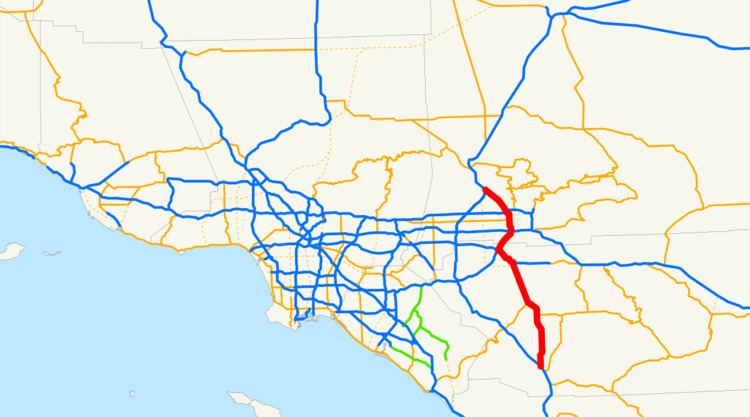
Interstate 215 (I-215) is a 54.5-mile (87.7 km) long north–south Interstate highway in the Inland Empire region of Southern California. It is an auxiliary route of Interstate 15 (I-15), running from Murrieta to northern San Bernardino. While I-215 connects the city centers of both Riverside and San Bernardino, its parent I-15 runs to the west through Corona and Ontario.
Contents
- Map of I 215 California USA
- Route description
- History
- San Bernardino widening project
- Exit list
- References
Map of I-215, California, USA
Part of I-215 was once signed as Interstate 15E (I-15E), but this was changed in 1974 as almost all of the Interstates around the country with directional suffixes were eventually renumbered or eliminated, except for I-35E and I-35W in Texas and Minnesota.
I-215 is part of the California Freeway and Expressway System and is eligible for the State Scenic Highway System.
Route description
The southern terminus of Interstate 215 is at the junction of Interstate 15 in the city of Murrieta just north of Temecula in southwestern Riverside County. It then runs north through Menifee and Perris before joining State Route 60 in Moreno Valley.
I-215 splits from SR 60 at State Route 91 in Riverside, where it then travels to San Bernardino before terminating at I-15 near the small San Bernardino neighborhood of Devore.
This route is an alternative to I-15 for drivers traveling from, for example, Phoenix, Las Vegas, and San Bernardino, to the San Diego metropolitan area. This route offers more of a distance advantage since it is an alternative to Interstate 15's alignment that is about 10 miles (16 km) to the west of, and roughly parallel to, I-215.
However, the traffic and time "advantage" on I-215 is limited by three factors: the segment between the I-15 / I-215 "Devore junction" and San Bernardino only has two lanes in each direction (on the other hand, I-15 has four), it is co-signed with SR 60 between Riverside and Moreno Valley, and that there are currently only two lanes in each direction between Perris and Menifee, although there has been work to widen approximately 12 miles (19 km) of I-215 to three lanes in each direction between the two cities. That project was completed up to Ethanac Road by November 2014 and was completed entirely in October 2015.
I-215 is also used by local residents as the major north–south route for the urbanized portions of the San Bernardino-Riverside-Ontario Metropolitan Area. (I-15 serves a similar function in the western portion of the metropolitan area; the two are the only continuous north–south freeways in the area.)
Interstate 215 is named the Escondido Freeway from its southern terminus in Murrieta to SR 60 in Moreno Valley. From that point to SR 91, I-215 is co-signed with SR 60 where it inherits the Moreno Valley Freeway name. From the SR 60/SR 91 interchange in Riverside to Interstate 10 in San Bernardino, the highway is known as the Riverside Freeway. Between I-10 and its northern terminus, I-215 is named the Barstow Freeway.
On January 24, 1957, the State Highway Commission defined the Escondido Freeway as what is now Routes 15 and 215 from Route 805 to Route 91. This entire segment was previously Route 395 when it was named. Since then, the definition was extended on Route 15 south to Route 8 by Assembly Concurrent Resolution 34, Chapter 67 in 1979. Meanwhile, the segment of Route 15 from the San Diego County Line to Lake Elsinore was named the Temecula Valley Freeway in 1990.
History
The highway (not an Interstate) that is currently Interstate 215 first opened in 1963 as part of U.S. Route 395. The "mileposts" in Riverside County reflect this, since they do not go to zero at the Interstate 15 interchange in Murrieta. In c. 1968, U.S. 395 was renumbered as I-15 (the original proposed route, as SR 71's proposed number was I-15W/SR 31 Hamner-Milliken). This segment of US 395 was again renumbered in 1972 as (Temporary) I-15E. Next in 1974, this route was renumbered as State Route 194. Next in 1982, this route was renumbered as I-215 north of SR 60, and as State Route 215 south of State Route 60. Once State Route 215 was upgraded to Interstate Highway standards, it became part of I-215 in 1994. Prior to its upgrade to Interstate Standards, there were traffic signals at SR 74, as well as at Alessandro Boulevard (in Moreno Valley); two railroad crossings had also intersected the 215 expressway at SR 74 and south of Cactus Avenue at then-March Air Force Base.
Due to the fact that the I-215 designation was overlaid upon existing freeways between the southern junction with SR 60 and the city of San Bernardino, the SR 60/SR 91/I-215 interchange in the city of Riverside has been widely known for its confusing nature concerning the numbering of I-215. While SR 60 continues east-and-west through this interchange, and SR 91 continues southwest (and formerly to the north), the I-215 designation continues away from this interchange on SR 60 east and the former northern portion of SR 91 (now solely numbered I-215). Travelers following I-215 in either direction need to "change freeways" at this interchange, instead of just following through lanes. The interchange was recently reconstructed to include some high-speed flyovers, one of which carries I-215 southbound traffic. In addition, when I-215 temporarily co-signs SR 60 in Riverside, the mileposts for I-215 supersede mileposts for SR 60. Motorists traveling east-west on SR 60 must begin counting exits at a new number, in the reverse order, during the I-215 overlap.
San Bernardino widening project
A joint project between Caltrans and SANBAG of San Bernardino County to widen I-215 between Orange Show Road and University Parkway in San Bernardino began in 2007. With its completion, the project added one general use lane and one carpool lane in each direction, bringing the total number of lanes from six to 10 lanes across. The 7.5-mile, $723 million project included the reconstruction of all underpasses and overpasses within the project as well as connector ramps between I-215 and SR-210. This major expansion and revitalization project will help reduce congestion and improve traffic flow on this freeway that serves as a gateway to Victor Valley, Riverside County, Orange County, Los Angeles County and points beyond. The widening was completed in late 2013, and all construction signage and equipment were completely removed by Spring of 2014.
Exit list
Except where prefixed with a letter, postmiles were measured on the road as it was in 1964, based on the alignment of US 395 as it existed at that time, and do not necessarily reflect current mileage. R reflects a realignment in the route since then, M indicates a second realignment, L refers an overlap due to a correction or change, and T indicates postmiles classified as temporary (for a full list of prefixes, see the list of postmile definitions). Segments that remain unconstructed or have been relinquished to local control may be omitted. The numbers reset at county lines; the start and end postmiles in each county are given in the county column.