
Length 30.29 km | ||
 | ||
History: 1963-1968 near East Los Angeles Interchange part of US 101 (Santa Ana Freeway), (deleted), 1982-1993 Century Freeway (completed) County Los Angeles County, California | ||
Interstate 105 (abbreviated I-105, and colloquially referred to as The 105 [pronounced the one-oh-five]) is an Interstate Highway in southern Los Angeles County, California that runs east–west from near the Los Angeles International Airport (LAX) to Norwalk. It is officially known as the Glenn Anderson Freeway for the Democratic California politician who advocated its construction. I-105 has also been referred to as the Century Freeway.
Contents
- Map of I 105 California USA
- Route description
- Metro Green Line
- Early planning
- Design and local opposition
- Keith v Volpe
- Century Freeway Housing Program
- Notable demolished buildings
- Post construction
- Interstate 105 1964 68
- Exit list
- In popular culture
- References
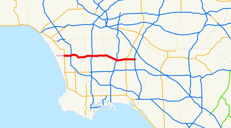
Map of I-105, California, USA
This route is part of the California Freeway and Expressway System.
Route description
The California Streets and Highways Code defines Route 105 as "from Pershing Drive near El Segundo to Route 605," but Caltrans never constructed the segment from Sepulveda Boulevard to Pershing Drive. Motorists can continue west via Imperial Highway over conventional roadway to Pershing Drive, but it is not part of Route 105 nor is it under state maintenance.
The 105 begins at Sepulveda Boulevard (State Route 1) on the southern edge of Los Angeles International Airport (LAX), adjacent to the city of El Segundo. It proceeds generally eastward from there on, crossing the Los Angeles and San Gabriel Rivers before terminating just east of the San Gabriel River Freeway (Interstate 605) in western Norwalk.
The freeway stops short of intersecting with the Santa Ana Freeway (Interstate 5), its parent interstate. Instead, the primary lanes of I-105 terminate at an at-grade intersection with Studebaker Road.
Much of the length of the Century Freeway runs parallel to Imperial Highway.
Metro Green Line
The Metro Green Line of the LACMTA runs in the median of I-105 for the majority of its route from Redondo Beach to Norwalk and near LAX in 2019.
Early planning
Interstate 105 was an integral part of a Caltrans 1960s master plan for the Southern California freeway system, but did not open until 1993. The right-of-way was included on several early highway plans since at least 1947, although it was not named the "Century Freeway" until 1956, and was numbered Route 42. In 1965, the Century Freeway was added to the state system originated at State Route 1 (Sepulveda Boulevard) east to Central Avenue in the City of Los Angeles along an alignment very near to the current right-of-way. The current route was added to the Interstate system in 1968.
Design and local opposition
The route was designed between 1968 and 1972, but opposition from some of the communities through which the right-of-way would pass slowed the process and led to some reroutings. Many factors contributed to the delay. The growth of the environmental movement in the 1960s created resistance to new freeway construction. Fiscal difficulties brought about by the 1971 Sylmar earthquake and the California tax revolt of the late 1970s further hampered Caltrans' construction efforts.
However, the major source of resistance to the freeway's construction was community opposition and the side effects of these demands. By the early 1970s, most of the areas in the freeway's path (and thus slated to be demolished) were predominantly African-American. Resentment over previous freeway projects' effects on other black communities resulted in significant modifications to the original route. Most cities along the way, weary of the noise and visual blight created by elevated freeways, demanded that the route be built far below grade in a "trench." Also another source for resistance to the freeway's construction was that much of the areas along the I-105 path was going to be built in low income, high crime neighborhoods, which also delayed the freeway's construction until the crime in the areas went down.
Norwalk, opposed to the freeway's proposed route through the center of the city, blocked the route from reaching its intended terminus at the Santa Ana Freeway; however, Caltrans had already decided to abandon that section due to the inability of the severely congested Santa Ana to accommodate any more traffic. The freeway eventually replaced Manchester Avenue and Firestone Boulevard (both State Route 42), which were roads roughly parallel to the freeway.
Keith v. Volpe
In 1972, community opposition resulted in a federal lawsuit, Keith v. Volpe, being filed, charging violation of various civil rights protections and the National Environmental Policy Act (NEPA). An important figure in the freeway's history was Harry Pregerson, a United States federal judge who presided over the lawsuit concerning the freeway's construction and chose to continue presiding over the case despite being promoted to a higher level court. The interchange with Interstate 110 is named the Judge Harry Pregerson Interchange in his honor. In 1972, Judge Pregerson enjoined the further development of the freeway until it has complied with the requirements of NEPA, the California Environmental Quality Act (CEQA), the Federal-Aid Highway Act, and the Uniform Relocation Assistance and Real Property Acquisition Act of 1970.
In 1979, this lawsuit resulted in a Consent Decree, amended in 1981, which imposed several conditions on development of the freeway, including additional public hearings, preparation of an environmental report, alterations to the design to reduce lanes and intersections, improve carpooling and provide for a transit way, which became the Los Angeles Metro Rail Green Line. A portion of the right-of-way was also to be constructed below grade to buffer adjacent areas from the effects of traffic noise. After construction began in the 1980s, failure to perform a full survey of the area's groundwater deposits, combined with the 20–30 foot below-grade trench through the city of Downey, resulted in buckling and cracking along the eastern portions of the route. At one point a large sinkhole opened in the Bellflower Boulevard on-ramp. This resulted in construction of an elaborate pump system along the freeway between the interchanges with I-710 and I-605.
Century Freeway Housing Program
A significant aspect of the Keith v. Volpe Consent Decree was the requirement that the housing removed to construct the freeway be replaced, leading to the creation of the Century Freeway Housing Program within the California Department of Housing and Community Development.
Notable demolished buildings
The childhood home of Brian, Carl and Dennis Wilson of The Beach Boys was demolished in the mid-1980s to make way for the freeway, as was the house across the street where their bandmate David Marks grew up. In 2005, the Beach Boys Historic Landmark was built on the former site of the Wilson brothers' home and declared a California Historic Landmark.
Another home in Downey, California, where siblings Richard and Karen Carpenter grew up before forming the musical duo The Carpenters, was also razed for the 105.
Post-construction
Throughout the difficulties, Congressman Glenn M. Anderson (D-San Pedro) tirelessly advocated for the route's construction, touting its possibilities for congestion relief along Century, Manchester, and Firestone Boulevards and the Imperial Highway; it succeeded in these tasks, as well as relieving pressure on the Santa Monica (I-10) and San Diego (I-405) Freeways for travelers between Downtown Los Angeles and LAX. After Anderson's death in 1994, Caltrans honored him by renaming the freeway in his honor. However, the route's original name, "Century Freeway", is still used on a number of maps.
The freeway was originally signed with El Segundo as its westbound control city; however, in recent years, many of the El Segundo signs have been replaced and/or covered with "LAX Airport" signage due to the western terminus' proximity to Los Angeles International Airport.
Shortly before opening, filmmakers had access to use the empty freeway for a number of weeks to film the 1994 motion picture Speed.
Interstate 105 (1964-68)
Previously, the I-105 designation was used for U.S. Route 101 (the Santa Ana Freeway) from I-5 (the Golden State Freeway) at the East Los Angeles Interchange to the connection to I-10 (the San Bernardino Freeway; this connection had been I-110); it went back to U.S. 101 in 1968.
Exit list
Except where prefixed with a letter, postmiles were measured on the road as it was in 1964, based on the alignment that existed at the time, and do not necessarily reflect current mileage. R reflects a realignment in the route since then, M indicates a second realignment, L refers an overlap due to a correction or change, and T indicates postmiles classified as temporary (for a full list of prefixes, see the list of postmile definitions). Segments that remain unconstructed or have been relinquished to local control may be omitted. The entire route is in Los Angeles County.
In popular culture
The I-105 and I-110 interchange was used in the 2016 musical film La La Land