
Length 68.88 km | ||
 | ||
Maintained by Bureau of Street Services, City of L.A. DPW, City of Culver City, City of El Segundo, City of Manhattan Beach, City of Hermosa Beach, City of Torrance, City of Carson, Co. of L.A. DPW, Caltrans Majorjunctions I-110 in West Carson / Carson I-105 near LAX Airport I-405 in Culver City I-10 & SR 2 West Los Angeles US 101 in Van Nuys SR 118 in Mission Hills | ||
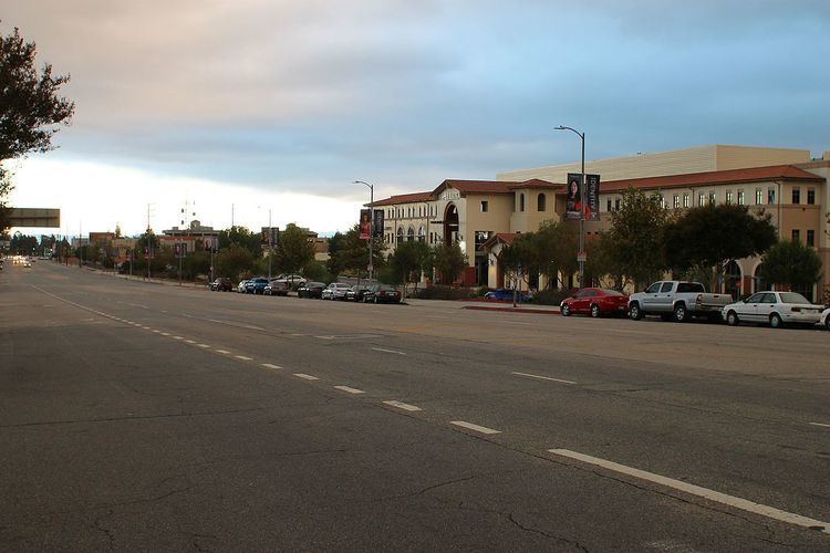
Sepulveda Boulevard is a major street and transportation corridor in the City of Los Angeles and several other cities in western Los Angeles County, California. It is around 42.8 miles (68.9 km) in length, making the longest street in the city and county of Los Angeles. Sepulveda Boulevard runs from Long Beach north through the South Bay and Westside regions, and over the Santa Monica Mountains at Sepulveda Pass to northern San Fernando Valley. It passes underneath two of the runways of Los Angeles International Airport (LAX). Portions of Sepulveda Boulevard are designated as Pacific Coast Highway (SR 1).
Contents
- Map of S Sepulveda Blvd Los Angeles CA USA
- History
- Street buses
- Rapid transit
- In popular culture
- References
Map of S Sepulveda Blvd, Los Angeles, CA, USA
History
In 1769, the Spanish Portola expedition, the first Europeans to see inland areas of California, traveled north through Sepulveda pass on August 5. The party had been travelling west, intending to reach and follow the coast, but were discouraged by the steep coastal cliffs beginning at today's Pacific Palisades and decided to detour inland. They found the pass through the Santa Monica Mountains and followed it into the San Fernando Valley.
Sepulveda Boulevard is named for the Sepulveda family of San Pedro, California. The termination of Sepulveda is on a part of the Sepulveda family ranch, Rancho Palos Verdes, which consisted of 31,619 acres (127.96 km2) of the Palos Verdes Peninsula. In 1784 the Spanish land grant for Rancho San Pedro was issued to Juan Jose Dominguez by King Carlos III—the Spanish Empire. A judicial decree was made by Governor José Figueroa which was intended to settle the land dispute between the Domínguez and Sepúlveda families. The rancho was formally divided in 1846, with Governor Pío Pico granting Rancho de los Palos Verdes to José Loreto and Juan Capistrano Sepulveda.
Sepulveda Boulevard begins in Long Beach at its intersection with Willow Street and the Terminal Island Freeway (SR 103). Willow Street extends to the east from here, eventually crossing into Orange County and becoming Katella Avenue, a major thoroughfare across that county.
Sepulveda then runs westward through Carson to the Harbor Freeway (I-110), where it then turns northwest, passing through the unincorporated area of West Carson (from I-110 to Normandie Avenue) and Harbor Gateway (from Normandie to Western Avenue), and Torrance.
After entering Redondo Beach, signage changes to Camino Real as it heads to Torrance Boulevard. The route then heads a few blocks west along Torrance Boulevard and then joins Pacific Coast Highway (SR 1). Originally PCH was on a section of the 19th century El Camino Real crossing the Rancho Sausal Redondo. The present day Camino Real section has El Camino Real bell markers along it.
From Torrance Boulevard north to Artesia Boulevard, signage on the SR 1/Sepulveda Boulevard overlap reads "Pacific Coast Highway" as it passes through Hermosa Beach. Sepulveda Boulevard signage resumes north of Artesia, and it then goes through Manhattan Beach and El Segundo. Sepulveda Boulevard then enters Los Angeles, crosses the western terminus of the Century Freeway (I-105), and goes through the LAX Airport Tunnel to pass under its runways. The road then passes through an interchange with Century Boulevard, which provides access to LAX's terminals to the west and the San Diego Freeway (I-405) to the east.
At the north end of LAX, SR 1/PCH branches to the west as Lincoln Boulevard while Sepulveda Boulevard continues north to become a primary thoroughfare through the Westside region cities and communities of Westchester, Culver City, West Los Angeles, and Westwood. In Culver City, north of Slauson Avenue, it merges for a few blocks with Jefferson Boulevard. From Jefferson, Sepulveda Boulevard runs parallel to the 405 as it goes through West Los Angeles and Westwood, passing the Los Angeles National Cemetery. After going past Bel Air, it parallels the freeway up the Sepulveda Canyon. At the Skirball Cultural Center, Sepulveda Boulevard then curves west away from the 405, passes under a tunnel under Mulholland Drive, and then follows a serpentine route down the north side of the Sepulveda Pass. It then passes under the 405 just before crossing Ventura Boulevard in Sherman Oaks. Sepulveda Boulevard then runs parallel to the east of the 405, crossing the Ventura Freeway (US 101) and the Los Angeles Metro Orange Line rapid transit route, and through San Fernando Valley communities of Van Nuys and North Hills, to its northern terminus at the Rinaldi Street interchange with the 405 in Mission Hills.
There is also a separate section of Sepulveda Boulevard in Sylmar, running from Roxford Street to San Fernando Road, that primarily is a frontage road along the Golden State Freeway (I-5). Prior to the construction of the 405 Freeway in the 1960s, that disjunct piece and the main section of Sepulveda Boulevard were one continuous street, separated when the 405 Freeway interchange with the Golden State Freeway was built atop the section between Rinaldi and Roxford Streets.
Street buses
Public transit along Sepulveda Boulevard is provided by several different bus lines. The north south-part provides bus service in the San Fernando Valley and through the Sepulveda Pass by Metro Local line 234 and Metro Rapid line 734, through West Los Angeles, Culver City and LAX by Culver City Transit Line 6 and Rapid 6, and from LAX onwards by Metro Local line 232. The west-east portion of Sepulveda Boulevard provides bus service by Torrance Transit line 7.
Rapid transit
The Los Angeles Metro Orange Line serves the Sepulveda Metro station in Van Nuys, located on Erwin Street a block west of Sepulveda Boulevard. The Orange Line crosses the Valley (east/west) from North Hollywood to Chatsworth.
The Los Angeles Metro Expo Line serves an elevated station at the intersection of Sepulveda and Exposition Boulevards in West Los Angeles. The Expo Line connects Downtown Los Angeles with Santa Monica.
The Los Angeles Metro Green Line runs along the south side of LAX. Its closest station to Sepulveda Boulevard is the Aviation/LAX Metro station, located 4 large blocks east, at the Century Freeway and Aviation Boulevard.