
Length 44.1 km | ||
 | ||
History: 1940s as a state highway, 1964 as a number North end: I-210 / Huntington Dr. in Irwindale | ||
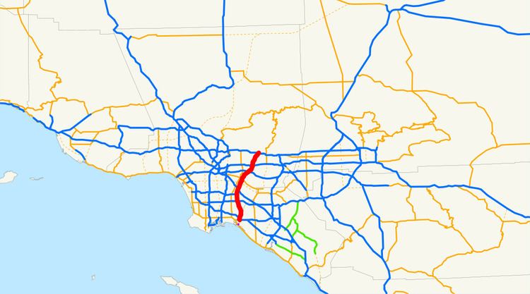
Interstate 605 (abbreviated I-605, officially known as the San Gabriel River Freeway and colloquially referred to as the 605 (the six-oh-five)) is a major north–south Interstate Highway in the Greater Los Angeles Area of Southern California. It is about 27 miles (43 km) in length, and runs from Seal Beach to Irwindale, closely paralleling the San Gabriel River for most of its alignment. The San Gabriel River Freeway is one of the few Southern California freeways not named after a city along its route.
Contents
Map of I-605, California, USA
This route is part of the California Freeway and Expressway System.
Route description
The California Streets and Highways Code defines Route 605 as "(a) Route 1 near Seal Beach to Route 405. (b) Route 405 to Route 210 near Duarte." However, the portion in subsection A has yet to be constructed.
The southern terminus of I-605 is at the San Diego (I-405) and Garden Grove (State Route 22) Freeways in Seal Beach. From there, it runs roughly north through the Gateway Cities of the Los Angeles Basin. It then shifts north-northeast, crossing the Whittier Narrows and across the San Gabriel Valley. I-605 then ends at its junction with the Foothill Freeway, (I-210) in Duarte, a small city located at the foothills of the San Gabriel Mountains.
I-605 follows most of the length of the San Gabriel River from the San Diego Freeway in Seal Beach to the Santa Fe Dam. Typically dry riverbed and flood basins are visible from many portions of the route, especially near the northern terminus. Also, the freeway features an HOV lane for carpools of two or more people throughout most of the route. The left shoulder is close to non-existent. The road also suffers from traffic jams regularly, especially near I-5 (the Santa Ana Freeway).
Signs along I-605's entrances and freeway junctions do not include destinations (control cities) such as "Seal Beach" or "Irwindale", but simply read "NORTH" or "SOUTH". In place of control cities, a simple "THRU TRAFFIC" designation is used on signs along I-605 itself.
Route 605 from Route 405 to Route 10 is known as the San Gabriel River Freeway, as named by Senate Bill 99, Chapter 1101 in 1967.
Transportation
Metro Express line 577 runs through Interstate 605 between Interstate 10 and Interstate 405. The Green Line serves the Norwalk Station at the interchange of the eastern terminus of Interstate 105. Foothill Transit Commuter Express Lines 493, 495, and 497 use Interstate 605 from the Interstate 10 interchange to continue their routes to the Pomona Freeway to destinations in City of Industry, Diamond Bar, and Chino.
History
In 1957, the number for this route was proposed as I-13, as it is positioned approximately midway between I-5 and I-15 (although it intersects the former). That number was rejected, as was the second proposed number, I-102. Finally, the designation I-605 was accepted in 1958.
Interstate 605 began construction in 1963 and the first section was opened in 1964 from Interstate 405 to Pomona Freeway CA 60. The newest section (extension to Interstate 210) was opened in 1971 was originally signed as SR 243. There are plans to extend it to SR 1 further south in Orange County, but strong community opposition means that it is unlikely that the alignment will ever be built.