
Length 133 km | ||
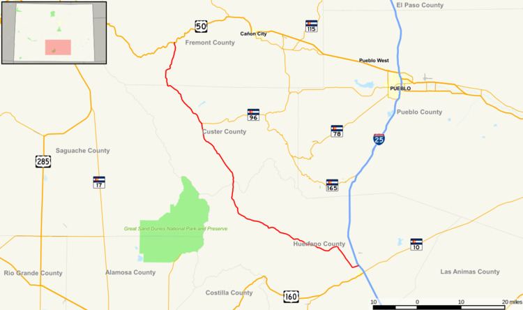 | ||
State Highway 69 is a highway in Colorado that connects Walsenburg and Westcliffe.
Contents
Map of CO-69, Colorado, USA
Route description
SH 69 runs 82.7 miles (133.1 km), starting at a junction with I-25 just north of Walsenburg. The highway heads northwest over Long Saddle Pass and Promontory Divide Pass to Westcliffe and ends at the Texas Creek junction with U.S. Highway 50 between Cañon City and Salida.
References
Colorado State Highway 69 Wikipedia(Text) CC BY-SA