
Prominence 55 m Parent range Spanish Peaks | Elevation 1,877 m Mountain range Spanish Peaks | |
 | ||
Topo map USGS 7.5' topographic mapHuerfano Butte, Colorado Similar East Spanish Peak, Mount Mestas, West Spanish Peak, Greenhorn Mountain, Mount Lindsey | ||
Huerfano Butte is an isolated volcanic neck located 8.8 miles (14.1 km) north by west (bearing 344°) of the City of Walsenburg in Huerfano County, Colorado, United States.
Map of Huerfano Butte, Colorado 81089, USA
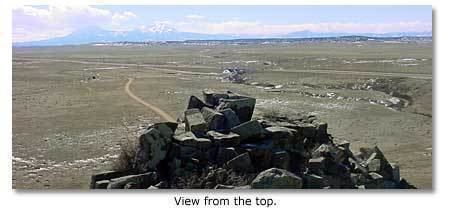
A remnant of an ancient volcano, it was named Huerfano (orphan) by early Spanish explorers. Its name is pronounced locally as WAR-fuh-no. It rises above the south side of the Huerfano River with its peak about 200 feet above the floodplain. The butte lies one half mile east of the Interstate 25 crossing of the Huerfano River.
References
Huerfano Butte Wikipedia(Text) CC BY-SA