
Local time Monday 1:20 AM | ||
 | ||
Weather 1°C, Wind NE at 42 km/h, 79% Humidity | ||
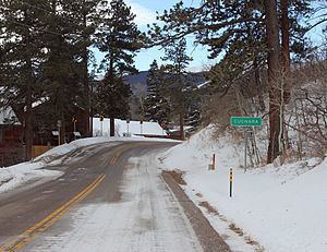
Cuchara is an unincorporated community in Huerfano County, Colorado, United States. It is located near a former ski resort in the mountains south of the town of La Veta. Its altitude is 8,468 feet (2,581 m). State Highway 12 travels through Cuchara as it approaches Trinidad to the southeast.
Map of Cuchara, CO 81055, USA
Cuchara is situated on the eastern slopes of the Sangre de Cristo Mountains in south-central Colorado. It is west of the Spanish Peaks. Cucharas Pass, at almost 10,000 feet, is a few miles south of the town of Cuchara. The Cucharas River flows on the outskirts of town. The San Isabel National Forest surrounds the town.
References
Cuchara, Colorado Wikipedia(Text) CC BY-SA