
Area 5,408 km² | Website Official website | |
 | ||
Points of interest Dhupgarh, Pandav Caves, Bee Fall, Handi Khoh, Apsara Vihar | ||
Hoshangabad District is one of the districts of Madhya Pradesh state of India, and Hoshangabad town is the district headquarters.
Contents
- Map of Hoshangabad Madhya Pradesh
- Geography
- History
- Demographics
- Languages
- Economy
- Agriculture
- Industries
- Tourism
- Road
- Rail
- Air
- Education
- Media
- References
Map of Hoshangabad, Madhya Pradesh
Geography
The district has an area of 5408.23 km². Hoshangabad district is bounded by the districts of Raisen to the north, Narsinghpur to the east, Chhindwara to the southeast, Betul to the south, Harda to the west, and Sehore to the northwest. In 1998, the western portion of Hoshangabad District was split off to become Harda District.
The district lies in the Narmada River valley, and the Narmada forms the northern boundary of the district, Hoshangabad District is part of [Hoshangabad] division. The Tawa River is a tributary of the Narmada, rising in the Satpura Range to the south and flowing north to meet the Narmada at the village of Bandra Bhan. The Tawa Reservoir lies in the south-central region of the district.
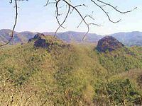
Hoshangabad District is also home to Pachmarhi, a hill station and popular tourist spot in the Satpura Range in the southern part of the district. Pachmarhi was the summer capital of the British Raj Central Provinces and Berar.
The Pachmarhi Sanctuary (461.37 km²) is part of the larger Pachmarhi Biosphere Preserve, which extends into Betul and Chhindwara districts.
The Rajat Prapat is located at Pachmarhi in Hoshangabad district. Bee Falls, Duchess Falls and Dupgrah, the highest peak of the Satpuras, are situated in Pachmarhi.
History
Hoshangabad district was part of the Nerbudda (Narmada) Division of the Central Provinces and Berar, which became the state of Madhya Bharat (later Madhya Pradesh) after India's independence in 1947.
Demographics
According to the 2011 census Hoshangabad District has a population of 1,240,975, roughly equal to the nation of Trinidad and Tobago or the US state of New Hampshire. This gives it a ranking of 387th in India (out of a total of 640). The district has a population density of 185 inhabitants per square kilometre (480/sq mi) . Its population growth rate over the decade 2001-2011 was 14.45%. Hoshangabad has a sex ratio of 912 females for every 1000 males, and a literacy rate of 76.52%. it is home to large number of Bhil's Adivasi people and Gurjars
Languages
Languages include Bhunjia, spoken by approximately 7000 Bhunjia Adivasis.
Economy
Hoshangabad is one of the fastest developing district of Madhya Pradesh
Agriculture
Agriculture growth is very high of the region. The land is quite fertile and farmers have good canal irrigation facilities from the Tawa Dam throughout the year. The farmers employ rotation of crops and their major income depends on Wheat, Soya Bean, Mung Bean,Sugarcane,Gram, Paddy cultivation etc. Hoshangabad is largest wheat producer and one of the largest Soya Bean producer district in India.
Industries
There are lot of large and small scale industries(Oil mill, Sugar mill, Wooden, Engineering etc.). Itarsi is largest economic center and logistic hub in the district. Security Paper Mill Hoshangabad and Ordnance Factory Itarsi are most valuable industrial unit of Government of India.
Tourism
Pachmarhi is known for its natural beauty at an altitude of 3,555 feet, surrounded by Satpura hills. Satpura National Park is famous for wild life in India.
Road
Rail
Itarsi Junction is one of the largest and busiest Railway Stations in India. Approximately 250 trains for all over India pass through this station. Other Railway Stations are Hoshangabad, Pipariya, Banapura Sohagpur Bankhedi .
Air
The nearest airport is Raja Bhoj Airport Bhopal.
Education
Out of 11 colleges, seven are Post Graduate Colleges. Post Graduate courses in Science/Arts/Commerce are available at the following Colleges:
Total Literacy of the District : 54.11%
Male Literacy of the District : 67.19%
Female Literacy of the District : 39.29%
Media
Newspapers:Hoshangabad has a few print publications newspapers such as, Dainik Bhaskar. Television:Doordarshan Broadcasting Center in Itarsi Pipariya and Pachmarhi.