
Elevation 3,564 m Mountain range Alps, High Tauern | Parent range Hohe Tauern Prominence 450 m | |
 | ||
First ascent In the 18th century by two farmers from Fusch called Zanker and Zorner Easiest route Over the northwest ridge (Kaindlgrat, I, Firnschneide 35°) Similar Hinterer Bratschenkopf, Klockerin, Hoher Tenn, Hohe Dock, Großvenediger | ||
Gro es wiesbachhorn
The Großes Wiesbachhorn ( [ˈɡʀoːsəs ˈviːsbaχˌhɔʁn]) is a mountain in the federal state of Salzburg, Austria and, at 3,564 m (AA) (according to other sources 3,570 m (AA)), is the third-highest peak of the Hohe Tauern range.
Contents
- Gro es wiesbachhorn
- Map of Grosses Wiesbachhorn 5672 Fusch Austria
- Gro es wiesbachhorn 3564m hd
- Location and area
- Ascents
- References
Map of Grosses Wiesbachhorn, 5672 Fusch, Austria
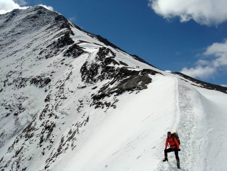
Its entirely free-standing firn-capped summit forms the main peak of the Fusch/Kaprun chain and is often viewed in Alpine literature as a rival of the Großglockner. The great slope on its eastern and southeastern side plunges 2,418 metres to the Fuscher Ache - the greatest height difference between mountaintop and valley floor in the Eastern Alps. Of alpinistic significance was the first ascent of the Northwest Face (Nordwestwand) on 15 July 1924 by Franz Riegele and Willo Welzenbach. They were the first ones to use ice nails (Eisnägel) to assist them; these were later developed into the ice screws used today. The Northwest Face was one of the classic ice walls of the Eastern Alps; the ice has since melted, however.
Gro es wiesbachhorn 3564m hd
Location and area
The Großes Wiesbachhorn is almost entirely surrounded by glaciers. To the north is the Wielingerkees, to the northeast the Sandbodenkees flows eastwards and down into the Sandboden and further into the Fuscher Ache. To the south lies the Teufelsmühlkees und im Westen das Kaindlkees. An important neighbouring mountain to the north, separated by the 3,211 metre high wind gap of the Sandbodenscharte, is the Kleines Wiesbachhorn with a height of 3,286 metres. To the southwest, on the other side of the 3,265 metre high Wielingerscharte, between the Kaindlkees and Teufelsmühlkees glaciers, lies the two Bratschenköpfe peaks (3,413 and 2,401 metres high). To the west the terrain falls away to the Mooserboden Reservoir, to the east into the Fuscher Tal. The nearest important settlement is Fusch an der Großglocknerstraße, about 10 kilometres away to the north as the crow flies.
Ascents
The route originally used by the Fusch farmers at the end of the 18th century is rarely used today. It runs from Ferleiten and takes 3½ hours to reach the Schwarzenberg Hut and from there another 4 hours past the Bratschenköpfe peaks to the summit of the Horn. The usual present-day start point for ascents is the Heinrich Schwaiger Haus. From there the standard route runs over the Oberen Fochezkopf and along the Kaindlgrat ridge to the summit in about 3 hours. In the middle section of the route there is a 35° inclined firn edge (Firnschneide), the rock sections are rated at climbing grade UIAA I. The classic routes through the 500 metre high Nordwest Face required ice climbing skills capable of coping with up to 60° gradients.