
Elevation 3,254 m (10,676 ft) | ||
 | ||
Mountains | ||
The Goldberg Group is a sub-group of the Hohe Tauern mountain range within the Central Eastern Alps. It is located in Austria, in the states of Salzburg and Carinthia. Its highest peak is the Hocharn, 3,254 m (AA). Other well known summits are the Hoher Sonnblick, with its observatory at 3,106 m (AA), and the Schareck at 3,123 m (AA)
Contents
Name
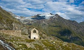
The name of the group is related to the rich mineral ores of the area and the associated historic mining. Gold was mined in the Rauris valley as well as in the Gastein valley (in the Radhausberg Massif), and helped those two valleys – and also the Archbishops of Salzburg as feudal lords – in the High Middle Ages to gain enormous wealth.
Not until the 19th century the mines were finally closed due to unprofitability. Even today, gold can be panned in the Rauris. Peaks like the Goldbergspitze (3,073 m) and Goldzechkopf (3,042 m) recall times long past when gold was mined in the High Tauern. In addition, silver – as indicated by Silberpfennig (2,600 m) – and other precious metals were mined, as were precious stones (aquamarine, garnet and others).
Geography
The Goldberg Group lies in the eastern half of the Hohe Tauern range. In the west of the group is the Großglockner High Alpine Road, in the east runs the Tauern Railway.
The boundaries of the Goldberg Group, based on the Alpine Club classification of the Eastern Alps, where they are shown as group no. 42, are formed as follows:
According to the Mountain Range Classification for the Austrian Cave Directory (Gebirgsgruppengliederung für das österreichische Höhlenverzeichnis) according to Hubert Trimmel, in which the group is given no. 2580, the boundary is not formed by the Mallnitzer Tauern above Nassfeld, but by the Hoher Tauern Pass and the Anlauf Valley.
Neighbouring ranges
Together with the Ankogel Group, the Glockner Group, the Schober Group, the Kreuzeck Group, the Granatspitz Group, the Venediger Group, the Villgraten Mountains and the Rieserferner Group, the Goldberg Group is among the major mountain groups of the High Tauern.
The Goldberg Group is bounded by the following other ranges in the Alps:
Subdivision
According to the Mountain Range Classification for the Austrian Cave Directory, the group is further subdivided as followed:
The Edelweißspitze Group (Radhausberg Massif) is part of the Ankogel Group according to the Alpine Club classification.
Summits
All the named three-thousanders in the Goldberg Group: