Neha Patil (Editor)

Schareck

Updated on
Edit
Like
Comment
Share on FacebookTweet on TwitterShare on LinkedInShare on Reddit
Isolation
  
6.90 km → Hocharn

Elevation
  
3,123 m

Schareck httpsuploadwikimediaorgwikipediacommonsthu

Prominence
  
427 m ↓ Niedere Scharte

Normal route
  
Ascent from the Mölltaler Gletscher Ski Region

Mountain range
  
Goldberg Group, High Tauern

Parent ranges
  
High Tauern, Goldberg Group

Similar
  
Hoher Sonnblick, Hocharn, Ankogel, Hochries, Grossglockner

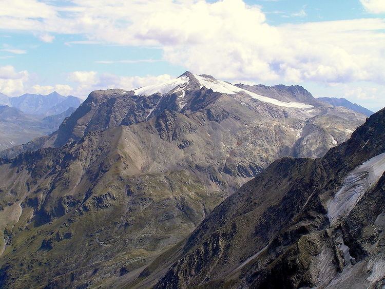
The Schareck, a mountain with a height of 3,123 m (AA), lies in the Goldberg Group of the High Tauern in Austria.

Contents

Map of Schareck, 5645, Austria

Location and landscapeEdit

The summit is located on the main chain of the Alps, exactly on the border between the states of Carinthia and Salzburg, ca. 4.8 km as the crow flies east-southeast of the Hoher Sonnblick. The Schareck is the second highest summit in the Goldberg range after the Hocharn. Southwest of the summit is the glacier of Wurtenkees and the ski region of Mölltaler Gletscher. Below the mountain is the Hochwurtenspeicher reservoir of the Fragant power station complex. To the north, another glacier, the Schareckkees, reaches to just below the top.

As a result of the opening of the ski region with its lift systems, ascending the Schareck from the south has virtually no climbing merit any longer.

AscentsEdit

  • From the south: from the top station of the highest chair lift it takes a few minutes to reach the summit
  • The so-called Pröll Way (Pröll-Weg), which is waymarked, offers an attractive climb from the northwest to the top. It runs from the Niedersachsenhaus along a sweeping mountain ridge or arête to the summit. This route, which crosses the Neuner Kogel (2,827 m) and the Herzog Ernst (2,933 m), is relatively easy to negotiate in dry and snow-free conditions albeit sure-footedness and a head for heights are required. There is one climbing section secured with footpegs (Trittstiften).
  • From Schutzhaus Neubau (Raurisertal/Kolm Saigurn) is a straightforward climb via the Tauerngold Erlebnisweg to the col of Fraganter Scharte and then onto the Herzog Ernst Spitze (2,933 m) taking ca. 2½ hours (path no. 119). From there one can reach the top of the Schareck in ca. 1 hour. The path is exposed in places (path no. 120).
  • From the northeast: from Sportgastein on the Neuwirt-Steig - Aperes Schareck - Schareckkees (crevasse-risk)
  • Literature and mapsEdit

  • Liselotte Buchenauer, Peter Holl: Ankogel- und Goldberggruppe, Alpine Club Guide, Bergverlag Rudolf Rother, Munich, 1986. ISBN 3-7633-1247-1
  • Alpine Club map Sheet 42, 1:25,000 series, Sonnblick
  • References

    Schareck Wikipedia