
Topo map USGS South Strafford Prominence 134 m | Elevation 571 m Easiest route Hiking | |
 | ||
Similar | ||
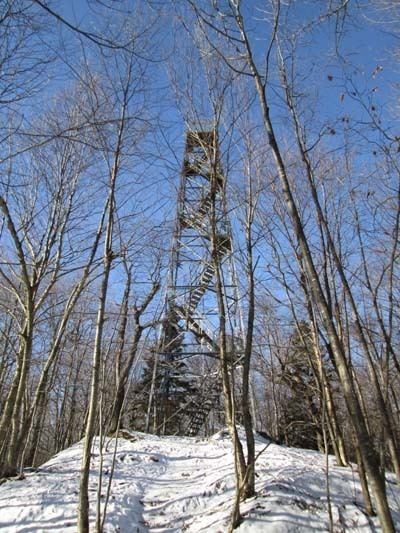
Gile Mountain is located in Windsor County, Vermont, along the border between the towns of Norwich and Sharon, with the summit located in Norwich. The mountain reaches a height of 1,873 feet (571 m) above sea level. Relatively unimposing considering its height, the true summit cannot easily be seen from the surrounding territory, despite the prominent fire tower atop its summit. The tower is easily reached by taking Turnpike Road from Norwich to the parking area near its terminus. From here, the Gile Mountain trail leads west 0.7 miles (1.1 km) to the summit, passing under power lines. The summit area contains an old ranger cabin, since converted to a shelter-type structure (though camping is not allowed), and the tower itself. From the top views are expansive, and on a clear day one can see Mount Ascutney to the south, the Green Mountains from Killington Peak to Mount Mansfield to the west, Mount Cardigan, Smarts Mountain, and Croydon Peak to the east, and Mount Cube and Mount Moosilauke to the northeast with many of the White Mountains beyond. Dartmouth College is also visible some seven miles distant.
Contents
Map of Gile Mountain, Norwich, VT 05055, USA
Geology
Gile Mountain is the type locality for the Devonian Gile Mountain Formation—interbedded quartzite & schist—which can be seen throughout northeastern Vermont.