
Founded 1781 Population 56,067 (2013) Unemployment rate 3.5% (Apr 2015) | Congressional district At-large Website www.swcrpc.org | |
 | ||
Rivers White River, Williams River, Ompompanoosuc River Points of interest Okemo Mountain Resort, Mount Ascutney, American Precision Museum, Joseph Smith Birthplac, Marsh‑Billings‑Rockefeller National Historical Destinations | ||
The simpsons springfield windsor county vermont united states north america
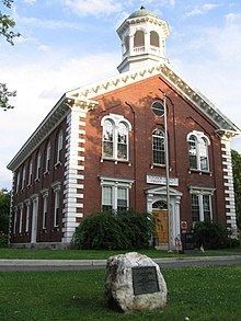
Windsor County is a county located in the U.S. state of Vermont. As of the 2010 census, the population was 56,670. The shire town (county seat) is the municipality of Woodstock. The county's largest municipality is Hartford.
Contents
- The simpsons springfield windsor county vermont united states north america
- Map of Windsor County VT USA
- History
- Geography
- Adjacent counties
- National parks
- 2000 census
- 2010 census
- Transportation
- Villages
- References
Map of Windsor County, VT, USA
History
Windsor County is notable for being the birthplace (1805) of the founder of the Church of Jesus Christ of Latter-day Saints, Joseph Smith, Jr.
Geography
According to the U.S. Census Bureau, the county has a total area of 977 square miles (2,530 km2), of which 969 square miles (2,510 km2) is land and 7.4 square miles (19 km2) (0.8%) is water. It is the largest county by area in Vermont.
Adjacent counties
National parks
2000 census
As of the census of 2000, there were 57,418 people, 24,162 households, and 15,729 families residing in the county. The population density was 59 people per square mile (23/km²). There were 31,621 housing units at an average density of 33 per square mile (13/km²). The racial makeup of the county was 97.72% White, 0.33% Black or African American, 0.23% Native American, 0.63% Asian, 0.03% Pacific Islander, 0.15% from other races, and 0.91% from two or more races. 0.82% of the population were Hispanic or Latino of any race. 20.1% were of English, 12.9% Irish, 10.9% American, 9.9% French, 7.7% German, 6.7% French Canadian and 5.5% Italian ancestry according to Census 2000. 96.4% spoke English and 1.5% French as their first language.
There were 24,162 households out of which 29.20% had children under the age of 18 living with them, 52.70% were married couples living together, 9.00% had a female householder with no husband present, and 34.90% were non-families. 28.10% of all households were made up of individuals and 11.10% had someone living alone who was 65 years of age or older. The average household size was 2.35 and the average family size was 2.86. In the county, the population was spread out with 23.30% under the age of 18, 5.90% from 18 to 24, 27.30% from 25 to 44, 27.60% from 45 to 64, and 15.80% who were 65 years of age or older. The median age was 41 years. For every 100 females there were 94.80 males. For every 100 females age 18 and over, there were 92.10 males.
The median income for a household in the county was $40,688, and the median income for a family was $59,002. Males had a median income of $42,648 versus $25,696 for females. The per capita income for the county was $22,369. About 3.20% of families and 5.70% of the population were below the poverty line, including 7.50% of those under age 18 and 7.60% of those age 65 or over.
In 2007, the census department estimated that Windsor had the oldest average age in the state, 44.7. This compares with the actual census in 2000 of 41.3 years.
2010 census
As of the 2010 United States Census, there were 56,670 people, 24,753 households, and 15,420 families residing in the county. The population density was 58.5 inhabitants per square mile (22.6/km2). There were 34,118 housing units at an average density of 35.2 per square mile (13.6/km2). The racial makeup of the county was 96.3% white, 0.9% Asian, 0.6% black or African American, 0.3% American Indian, 0.2% from other races, and 1.7% from two or more races. Those of Hispanic or Latino origin made up 1.2% of the population. In terms of ancestry, 23.2% were English, 17.3% were Irish, 11.8% were German, 8.3% were American, 7.6% were Italian, 6.1% were Scottish, and 5.6% were French Canadian.
Of the 24,753 households, 25.9% had children under the age of 18 living with them, 49.1% were married couples living together, 9.0% had a female householder with no husband present, 37.7% were non-families, and 30.0% of all households were made up of individuals. The average household size was 2.25 and the average family size was 2.77. The median age was 45.8 years.
The median income for a household in the county was $50,893 and the median income for a family was $63,387. Males had a median income of $44,610 versus $34,150 for females. The per capita income for the county was $29,053. About 5.6% of families and 9.7% of the population were below the poverty line, including 12.5% of those under age 18 and 7.6% of those age 65 or over.
Transportation
In 2009, the United States Department of Transportation measured 113.6 miles (182.8 km) of "major arteries", the highest in the state.
Because US Route 4 had the "feel" of a highway, motorists were inclined to speed. As a result, the Windsor County Sheriff's Department wrote 2,452 tickets in 2007.
Villages
Villages are census divisions, but have no separate corporate existence from the surrounding towns.