
Length 58.9 km | ||
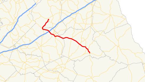 | ||
State Route 98 (SR 98) is a 36.6-mile-long (58.9 km) state highway that runs southeast-to-northwest through portions of Madison, Jackson, and Banks counties in the northeastern part of the U.S. state of Georgia. The route connects the Comer and Homer areas of the state.
Contents
Map of GA-98, Georgia, USA
Route description
SR 98 begins at an intersection with SR 72 (West Sunset Avenue) in Comer, within Madison County. It heads northwest to an intersection with SR 172. Then, it meets the southern terminus of SR 191. The route continues to the northwest to Danielsville, where it intersects US 29/SR 8 (General Daniels Avenue North). Northwest of Danielsville is Ila. In that town is SR 106 (Main Street). It passes into Jackson County and enters the city of Commerce. It first meets US 441/SR 15 (Veterans Memorial Parkway). It heads in a westerly direction to meet US 441 Business/SR 334 (South Elm Street). Here, SR 334 meets its northern terminus, while US 441 Business/SR 98 run concurrent farther into the city. At Central Avenue is the western terminus of SR 326. Farther to the northwest, they meet SR 15 Alternate. US 441 Business/SR 15 Alternate head to the north-northeast, while SR 98 continues through the city. Just before leaving Commerce is an interchange with Interstate 85 (I-85). Just after entering Maysville, it intersects the northern terminus of SR 82 Connector. Farther into town, it crosses into Banks County immediately before meeting the eastern terminus of SR 52 (Gillsville Road). SR 98 travels to the northeast, until it meets its northern terminus, an intersection with SR 164 in the town of Homer.