
Named for Richard Banks Area 606.1 km² Population 18,415 (2013) | Website www.bankscountyga.org Founded 1859 | |
 | ||
Rivers Nails Creek, Black Creek, Ragsdale Creek | ||
Banks County is a county located in the northeastern part of the U.S. state of Georgia. As of the 2010 census, the population was 18,395. The county seat is Homer. The Old Banks County Courthouse is located in Homer, Georgia and listed on the National Register of Historic Places. A newer county courthouse was constructed in 1983.
Contents
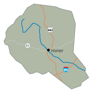
- Map of Banks County GA USA
- History
- Geography
- Adjacent counties
- National protected area
- 2000 census
- 2010 census
- Education
- Communities
- References
Map of Banks County, GA, USA
History
The law to establish Banks County was passed by the Georgia General Assembly on December, 11, 1858. It was named for Dr. Richard E. Banks. The legislation called for the creation of Banks County on February 1, 1859, from Franklin and Habersham Counties.
Ty Cobb, a Baseball Hall of Famer, was born in Banks County in 1886 in an area of the county known as The Narrows - a small farming community consisting of fewer than 100 people. The area and birthplace are on State Highway 105 in the northern part of the county near the Broad River. The legal organ for the county is The Banks County News, a member of Mainstreet News, Inc. One of the county's oldest church sites is the Hebron Presbyterian Church, established in 1796. Banks County is the home of the Atlanta Dragway, located near Banks Crossing. Banks County is also known for being the home of the former world's largest Easter Egg Hunt. (The 50th annual egg hunt in 2009 was the final)
Geography
According to the U.S. Census Bureau, the county has a total area of 234 square miles (610 km2), of which 232 square miles (600 km2) is land and 1.8 square miles (4.7 km2) (0.8%) is water. Banks County is entirely located in the Broad River sub-basin of the Savannah River basin.
Adjacent counties
National protected area
2000 census
As of the census of 2000, there were 14,422 people, 5,364 households, and 4,162 families residing in the county. The population density was 62 people per square mile (24/km²). There were 5,808 housing units at an average density of 25 per square mile (10/km²). The racial makeup of the county was 93.16% White, 3.22% Black or African American, 0.30% Native American, 0.60% Asian, 0.06% Pacific Islander, 1.96% from other races, and 0.71% from two or more races. 3.42% of the population were Hispanic or Latino of any race.
There were 5,364 households out of which 35.60% had children under the age of 18 living with them, 65.40% were married couples living together, 7.90% had a female householder with no husband present, and 22.40% were non-families. 19.20% of all households were made up of individuals and 7.70% had someone living alone who was 65 years of age or older. The average household size was 2.69 and the average family size was 3.06.
In the county, the population was spread out with 26.20% under the age of 18, 8.90% from 18 to 24, 30.70% from 25 to 44, 23.70% from 45 to 64, and 10.50% who were 65 years of age or older. The median age was 35 years. For every 100 females there were 102.00 males. For every 100 females age 18 and over, there were 99.70 males.
The median income for a household in the county was $38,523, and the median income for a family was $43,136. Males had a median income of $29,986 versus $21,698 for females. The per capita income for the county was $17,424. About 9.80% of families and 12.50% of the population were below the poverty line, including 14.00% of those under age 18 and 16.30% of those age 65 or over.
2010 census
As of the 2010 United States Census, there were 18,395 people, 6,700 households, and 5,100 families residing in the county. The population density was 79.3 inhabitants per square mile (30.6/km2). There were 7,595 housing units at an average density of 32.7 per square mile (12.6/km2). The racial makeup of the county was 91.7% white, 2.3% black or African American, 0.9% Asian, 0.3% American Indian, 3.3% from other races, and 1.4% from two or more races. Those of Hispanic or Latino origin made up 5.7% of the population. In terms of ancestry, 18.7% were American, 8.5% were Irish, and 8.5% were English.
Of the 6,700 households, 36.8% had children under the age of 18 living with them, 60.6% were married couples living together, 10.2% had a female householder with no husband present, 23.9% were non-families, and 20.2% of all households were made up of individuals. The average household size was 2.75 and the average family size was 3.14. The median age was 38.4 years.
The median income for a household in the county was $40,455 and the median income for a family was $48,606. Males had a median income of $41,444 versus $26,998 for females. The per capita income for the county was $19,497. About 13.0% of families and 15.9% of the population were below the poverty line, including 15.9% of those under age 18 and 16.6% of those age 65 or over.
Education
Banks County Middle School BCES BCHS BCPS