
Area Ranked 8th | Coastline 4,989 km (3,100 mi) | |
 | ||
Borders Chile 6,691 km (4,157 mi)Paraguay 2,351 km (1,460 mi)Brazil 1,263 km (784 mi)Bolivia 942 km (585 mi)Uruguay 541 km (336 mi) Highest point Cerro Aconcagua, 6,960 m | ||
The geography of Argentina describes the geographic features of Argentina, a country located in southern South America (or Southern Cone). Bordered by the Andes in the west and the South Atlantic Ocean to the east, neighboring countries are Chile to the west, Bolivia and Paraguay to the north, and Brazil and Uruguay to the northeast.
Contents
- Map of Argentina
- Regions
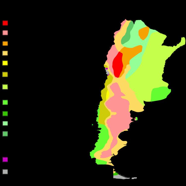
- Land use
- Climate
- Geographical politics
- Territorial claims
- National parks
- Antipodes
- References
Map of Argentina
In terms of area, Argentina is the second largest country of South America after Brazil, and the 8th largest country in the world. Its total area is approximately 2.7 million km². Argentina claims a section of Antarctica (Argentine Antarctica) but has agreed to suspend sovereignty disputes in the region as a signatory to the Antarctic Treaty. Argentina also asserts claims to several South Atlantic islands administered by the United Kingdom.
With a population of more than 42.1 million, Argentina ranks as the world's 32nd most populous country as of 2010.
Regions
Argentina's provinces are divided in 7 zones regarding climate and terrain. From North to South, West to East:
Land use
Climate
Argentina is subject to a variety of climates. The north of the country, including latitudes in and below the Tropic of Capricorn, is characterized by very hot, humid summers (which result in a lot of swamp lands) with mild drier winters, and is subject to periodic droughts during the winter season.
Central Argentina has hot summers with tornadoes and thunderstorms (in western Argentina producing some of the world's largest hail), and cool winters. The southern regions have warm summers and cold winters with heavy snowfall, especially in mountainous zones. Higher elevations at all latitudes experience cooler conditions.
Geographical politics
International agreements:
Strategic importance:
Territorial claims
National parks
The National Parks of Argentina make up a network of 30 national parks in Argentina. The parks cover a very varied set of terrains and biotopes, from Baritú National Park on the northern border with Bolivia to Tierra del Fuego National Park in the far south of the continent (see List of national parks of Argentina).
The creation of the National Parks dates back to the 1903 donation of 73 square kilometres of land in the Lake District in the Andes foothills by Francisco Moreno. This formed the nucleus of a larger protected area in Patagonia around San Carlos de Bariloche. In 1934, a law was passed creating the National Parks system, formalising the protected area as the Nahuel Huapi National Park and creating the Iguazú National Park. The National Park Police Force was born, enforcing the new laws preventing tree-felling and hunting. Their early task was largely to establish national sovereignty over these disputed areas and to protect borders.
Five further national parks were declared in 1937 in Patagonia and the service planned new towns and facilities to promote tourism and education. Six more were declared by 1970.
In 1970 a new law established new categories of protection, so that there now were National Parks, National Monuments, Educational Reserves and Natural Reserves. Three national parks were declared in the 1970s. In 1980, another new law affirmed the status of national parks - this law is still in place. The 1980s saw the service reaching out to local communities and local government to help in the running and development of the national parks. Ten more national parks were created with local co-operation, sometimes at local instigation. In 2000, Mburucuyá and Copo National Parks were declared, and El Leoncito natural reserve was upgraded to a national park.
The headquarters of the National Park Service are in downtown Buenos Aires, on Santa Fe Avenue. A library and information centre are open to the public. The administration also covers the national monuments, such as the Petrified Forest, and natural and educational reserves.
Antipodes
Argentina is largely antipodal to central and coastal China.